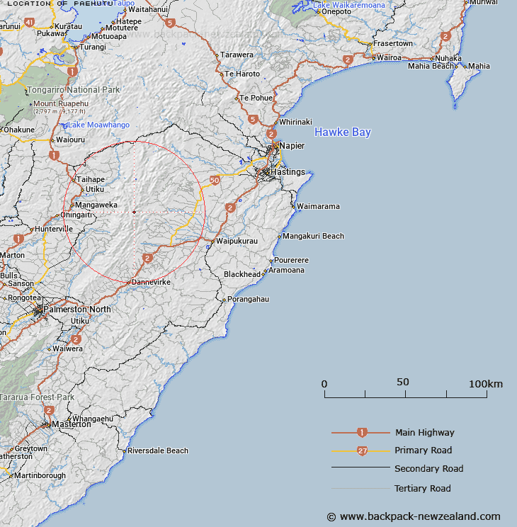
Map showing location of Paemutu


LINZ description: East of Broken Ridge at 1682m height, nortrh of the Ruahine Range.
Latitude: -39.842875
Longitude: 176.12753
Northing: 5585000
Easting: 1867600
Land District: Hawke's Bay
Feat Type: Trig Station


Scroll down to see a more detailed road map and below that a topographical map showing the location of Paemutu. The road map has been supplied by openstreetmap and the topographical map of Paemutu has been supplied by Land Information New Zealand (LINZ).

Yes you can use the top static map for you school/university project or personal website with a link back. Contact me for any commercial use.

Paemutu Map New Zealand


New Zealand places in our database
[ A ] [ B ] [ C ] [ D ] [ E ] [ F ] [ G ] [ H ] [ I ] [ J ] [ K ] [ L ] [ M ] [ N ] [ O ] [ P ] [ Q ] [ R ] [ S ] [ T ] [ U ] [ V ] [ W ] [ X ] [ Y ] [ Z ]


Closest 20 Trig Stations to Paemutu

Ohuinga ( 2.1km )   Kawhatau ( 4.55km )   Mangaweka ( 4.55km )   Te Atuaoparapara ( 5.25km )   Remutupo ( 15.2km )   Waikamaka ( 15.2km )   Pohatuhaha ( 23.56km )   Parks Peak ( 23.56km )   Wairakai ( 36.09km )   Salisbury ( 38.03km )   Matanginui ( 40.71km )   Matanganui ( 40.71km )   Ross ( 45.96km )   Kohinga ( 51.18km )   Wharite ( 51.25km )   Mangamahu ( 56.12km )   Kuripapango ( 57.02km )   Puketautahi ( 59.79km )   Wahatuara ( 61.91km )   Wahataura ( 61.91km )   Kaiarahi ( 62.27km )   Tawheketewhango ( 63.19km )   Tawake Tohunga ( 63.19km )   Tauwheketewhango ( 63.19km )   Tawai-Tohunga ( 63.19km )   Kauranaki ( 63.78km )   Kahuranaki ( 63.78km )   Pukenikau ( 68.88km )   Pukemiki ( 68.88km )   End ( 69.89km )   Otuarehua ( 73.5km )   Thunderbolt ( 74.48km )   Parewanui ( 81.25km )   Parawanui ( 81.25km )   Parahakipaku ( 84.38km )   Waka Atea ( 87.35km )   Wakaateo ( 87.35km )   Kopukore ( 91.73km )   Kupukore ( 91.73km )   Pakowhai ( 95.2km )