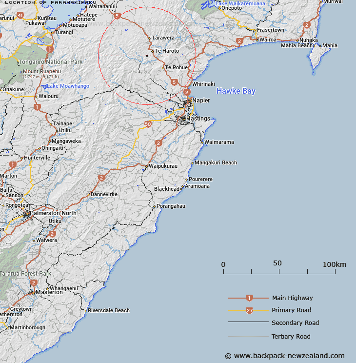
Map showing location of Parahakipaku


LINZ description: Located in the Awahohonu Forest, east of the Ripia River and west of the Mohaka River.
Latitude: -39.159504
Longitude: 176.555213
Northing: 5659500
Easting: 1907200
Land District: Hawke's Bay
Feat Type: Trig Station


Scroll down to see a more detailed road map and below that a topographical map showing the location of Parahakipaku. The road map has been supplied by openstreetmap and the topographical map of Parahakipaku has been supplied by Land Information New Zealand (LINZ).

Yes you can use the top static map for you school/university project or personal website with a link back. Contact me for any commercial use.

Parahakipaku Map New Zealand


New Zealand places in our database
[ A ] [ B ] [ C ] [ D ] [ E ] [ F ] [ G ] [ H ] [ I ] [ J ] [ K ] [ L ] [ M ] [ N ] [ O ] [ P ] [ Q ] [ R ] [ S ] [ T ] [ U ] [ V ] [ W ] [ X ] [ Y ] [ Z ]


Closest 20 Trig Stations to Parahakipaku

Waka Atea ( 12.96km )   Wakaateo ( 12.96km )   Tataraakin ( 13.81km )   End ( 14.58km )   Kaiarahi ( 23.81km )   Patuwahine ( 26.93km )   Kuripapango ( 28.6km )   Kohinga ( 33.5km )   Puketautahi ( 39.17km )   Tauwheketewhango ( 41.99km )   Tawake Tohunga ( 41.99km )   Tawai-Tohunga ( 41.99km )   Tawheketewhango ( 41.99km )   Pukaramea ( 44.09km )   Pukakaramea ( 44.09km )   Patuwahine ( 47.9km )   Thunderbolt ( 51.66km )   Tuwatawata ( 53.22km )   Tuawatawata ( 53.22km )   Maporiki ( 56.83km )   Mapouriki ( 56.83km )   Salisbury ( 57.24km )   Pohatuhaha ( 60.89km )   Parks Peak ( 60.89km )   Motuoapa ( 65.46km )   Kioronui ( 67.7km )   Kiorenui ( 67.7km )   Remutupo ( 69.82km )   Waikamaka ( 69.82km )   Kauranaki ( 75.73km )   Kahuranaki ( 75.73km )   Oiraraorao ( 75.79km )   Te Atuaoparapara ( 79.22km )   Tawhiwhau ( 80.83km )   Tawhiuau ( 80.83km )   Wharekaunga ( 82.67km )   Wharekauanga ( 82.67km )   Mangaweka ( 83.56km )   Kawhatau ( 83.56km )   Te Tahi ( 83.97km )