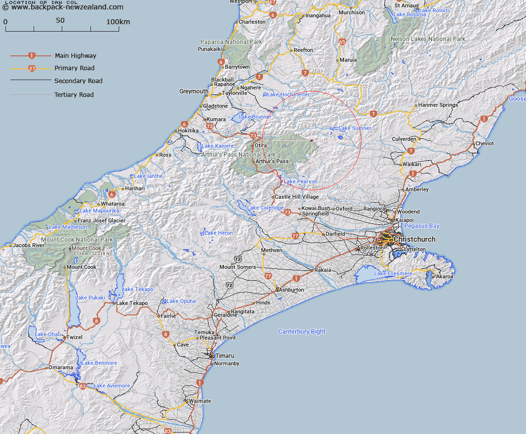
Map showing location of Ian Col


LINZ description: Col on the Dampier Range, between Hurunui and Waimakariri Rivers at the head of North Esk River and Bull Creek.
Latitude: -42.785857
Longitude: 172.020676
Northing: 5262500
Easting: 1519900
Land District: Canterbury
Feat Type: Pass


Scroll down to see a more detailed road map and below that a topographical map showing the location of Ian Col. The road map has been supplied by openstreetmap and the topographical map of Ian Col has been supplied by Land Information New Zealand (LINZ).

Yes you can use the top static map for you school/university project or personal website with a link back. Contact me for any commercial use.

Ian Col Map New Zealand


New Zealand places in our database
[ A ] [ B ] [ C ] [ D ] [ E ] [ F ] [ G ] [ H ] [ I ] [ J ] [ K ] [ L ] [ M ] [ N ] [ O ] [ P ] [ Q ] [ R ] [ S ] [ T ] [ U ] [ V ] [ W ] [ X ] [ Y ] [ Z ]


Closest 20 Passs to Ian Col

Roche Pass ( 4.28km )   Cox Saddle ( 9.11km )   Harper Pass ( 13km )   Foy Pass ( 13.92km )   Penny Pass ( 13.99km )   Koeti Pass ( 15.02km )   Minchin Pass ( 17.09km )   Trent Saddle ( 19.46km )   Rover Saddle ( 19.8km )   Hope Pass ( 20.59km )   Kiwi Saddle ( 21.27km )   Casey Saddle ( 22.5km )   Worsley Pass ( 22.75km )   Trudge Col ( 24.33km )   Binser Saddle ( 27.63km )   Walker Pass ( 27.85km )   Tarn Col ( 29.77km )   Amber Col ( 30.16km )   Taruahuna Pass ( 30.49km )   Waharoa Saddle ( 30.66km )   Amuri Pass ( 32.27km )   Nancy-Tass Saddle ( 32.47km )   Goldney Saddle ( 33.92km )   Goat Pass ( 34.75km )   Beau Saddle ( 35.03km )   Jacks Saddle ( 35.29km )   Williams Saddle ( 35.65km )   St Bernard Saddle ( 36.26km )   Red Saddle ( 37.28km )   Temple Col ( 37.64km )   Long Hill Saddle ( 38.23km )   Kelly Saddle ( 38.25km )   Okuku Saddle ( 38.26km )   Lees Pass ( 39.2km )   Arthur's Pass ( 39.94km )   Devilskin Saddle ( 40.14km )   Hunt Saddle ( 42.06km )   Waimakariri Col ( 44.07km )   Cass Saddle ( 45.2km )   Lagoon Saddle ( 45.51km )