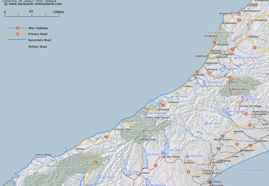
Map showing location of Nancy-Tass Saddle


LINZ description: Feature shown on: NZMS260 L32 Edition 1 1993 Limited Revision 1996
Latitude: -42.498139
Longitude: 171.953
Northing: 5294382.5
Easting: 1513969.1
Land District: Westland
Feat Type: Pass


Scroll down to see a more detailed road map and below that a topographical map showing the location of Nancy-Tass Saddle. The road map has been supplied by openstreetmap and the topographical map of Nancy-Tass Saddle has been supplied by Land Information New Zealand (LINZ).

Yes you can use the top static map for you school/university project or personal website with a link back. Contact me for any commercial use.
Nancy-Tass Saddle Map New Zealand


New Zealand places in our database
[ A ] [ B ] [ C ] [ D ] [ E ] [ F ] [ G ] [ H ] [ I ] [ J ] [ K ] [ L ] [ M ] [ N ] [ O ] [ P ] [ Q ] [ R ] [ S ] [ T ] [ U ] [ V ] [ W ] [ X ] [ Y ] [ Z ]


Closest 20 Passs to Nancy-Tass Saddle

Hope Pass ( 17.2km )   Amuri Pass ( 18.62km )   Mary Maruia Saddle ( 20.69km )   Rahu Saddle ( 24.54km )   Trent Saddle ( 25.76km )   Harper Pass ( 26.25km )   Devilskin Saddle ( 28.41km )   Foy Pass ( 30.04km )   Kiwi Saddle ( 30.21km )   Roche Pass ( 31.09km )   Cox Saddle ( 31.28km )   Koeti Pass ( 32.24km )   Ian Col ( 32.47km )   Penny Pass ( 33.7km )   Minchin Pass ( 33.81km )   Rover Saddle ( 36.97km )   Lewis Pass ( 39.1km )   Waharoa Saddle ( 41.44km )   Worsley Pass ( 41.71km )   Reefton Saddle ( 41.94km )   Henry Saddle ( 43.12km )   Anne Saddle ( 44.11km )   Trudge Col ( 45.67km )   Kelly Saddle ( 45.99km )   Ada Pass ( 47km )   Walker Pass ( 48.3km )   Three Tarn Pass ( 48.49km )   Casey Saddle ( 48.83km )   Tarn Col ( 48.83km )   Waitahu Saddle ( 48.95km )   Taruahuna Pass ( 49.4km )   Larry Saddle ( 49.7km )   Amber Col ( 50.34km )   Hunt Saddle ( 51.47km )   Beau Saddle ( 52.3km )   Goat Pass ( 52.34km )   Rappahannock Saddle ( 52.71km )   Temple Col ( 54.21km )   Saddle Spur ( 54.91km )   Charlies Saddle ( 55.06km )