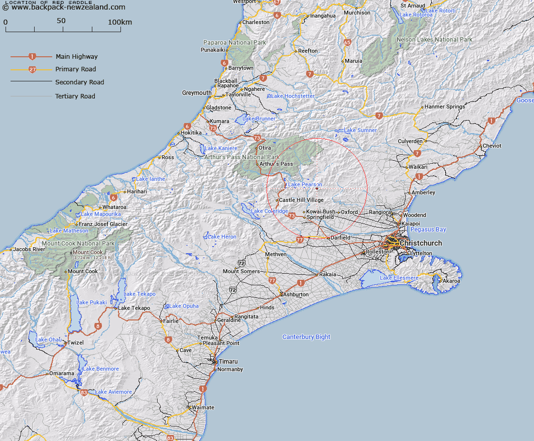
Map showing location of Red Saddle


LINZ description: Saddle in the Puketeraki Range, 1 mile south of Chest Peak between Whistler River and Waimakariri River.
Latitude: -43.121138
Longitude: 172.024353
Northing: 5225270.9
Easting: 1520632.8
Land District: Canterbury
Feat Type: Pass


Scroll down to see a more detailed road map and below that a topographical map showing the location of Red Saddle. The road map has been supplied by openstreetmap and the topographical map of Red Saddle has been supplied by Land Information New Zealand (LINZ).

Yes you can use the top static map for you school/university project or personal website with a link back. Contact me for any commercial use.

Red Saddle Map New Zealand


New Zealand places in our database
[ A ] [ B ] [ C ] [ D ] [ E ] [ F ] [ G ] [ H ] [ I ] [ J ] [ K ] [ L ] [ M ] [ N ] [ O ] [ P ] [ Q ] [ R ] [ S ] [ T ] [ U ] [ V ] [ W ] [ X ] [ Y ] [ Z ]


Closest 20 Passs to Red Saddle

West Hoe Pass ( 13.65km )   Ashley Saddle ( 14.28km )   Big Ben Saddle ( 15.68km )   St Bernard Saddle ( 18.7km )   Long Hill Saddle ( 18.8km )   Binser Saddle ( 19.71km )   Okuku Saddle ( 23.62km )   The Gap ( 24.63km )   Goldney Saddle ( 25.6km )   Casey Saddle ( 27.16km )   Cass Saddle ( 28.14km )   Lees Pass ( 29.37km )   Porters Pass ( 30.19km )   Pig Saddle ( 32.21km )   Okuku Pass ( 34.53km )   Trudge Col ( 34.65km )   Walker Pass ( 35.64km )   Lagoon Saddle ( 35.9km )   Amber Col ( 36.08km )   Williams Saddle ( 36.5km )   Ian Col ( 37.28km )   Coleridge Pass ( 37.36km )   Tarn Col ( 37.69km )   Taruahuna Pass ( 37.98km )   Worsley Pass ( 37.99km )   Hill Saddle ( 38.13km )   Roche Pass ( 38.47km )   Limestone Saddle ( 38.73km )   Cox Saddle ( 39.32km )   Penny Pass ( 39.33km )   Bruce Saddle ( 40.14km )   Rover Saddle ( 40.39km )   Goat Pass ( 40.54km )   Minchin Pass ( 41.33km )   Koeti Pass ( 41.36km )   High Peak Saddle ( 42.2km )   Yorkies Saddle ( 42.44km )   Foy Pass ( 42.65km )   Temple Col ( 42.76km )   Jordan Saddle ( 42.9km )