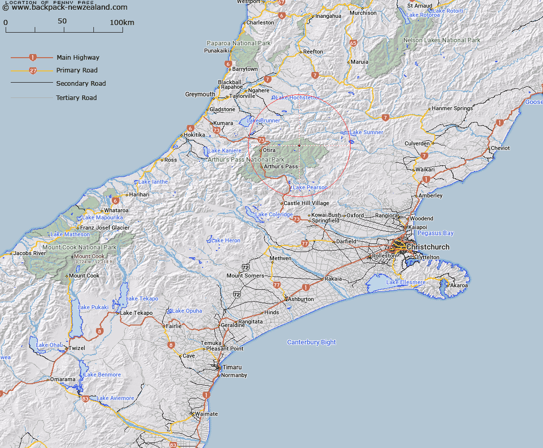
Map showing location of Penny Pass


LINZ description: North west of Poulter Range and south west of Dampier Range, due east of Minchin Pass.
Latitude: -42.791468
Longitude: 171.849407
Northing: 5261700
Easting: 1505900
Land District: Canterbury
Feat Type: Pass


Scroll down to see a more detailed road map and below that a topographical map showing the location of Penny Pass. The road map has been supplied by openstreetmap and the topographical map of Penny Pass has been supplied by Land Information New Zealand (LINZ).

Yes you can use the top static map for you school/university project or personal website with a link back. Contact me for any commercial use.

Penny Pass Map New Zealand


New Zealand places in our database
[ A ] [ B ] [ C ] [ D ] [ E ] [ F ] [ G ] [ H ] [ I ] [ J ] [ K ] [ L ] [ M ] [ N ] [ O ] [ P ] [ Q ] [ R ] [ S ] [ T ] [ U ] [ V ] [ W ] [ X ] [ Y ] [ Z ]


Closest 20 Passs to Penny Pass

Koeti Pass ( 2.06km )   Minchin Pass ( 3.22km )   Foy Pass ( 3.7km )   Cox Saddle ( 5.14km )   Rover Saddle ( 5.91km )   Harper Pass ( 7.51km )   Worsley Pass ( 9.75km )   Roche Pass ( 9.93km )   Trent Saddle ( 10.21km )   Trudge Col ( 12.76km )   Ian Col ( 13.99km )   Casey Saddle ( 15.19km )   Walker Pass ( 16.01km )   Waharoa Saddle ( 16.67km )   Tarn Col ( 17.37km )   Taruahuna Pass ( 18.07km )   Amber Col ( 18.31km )   Goat Pass ( 22.06km )   Binser Saddle ( 23.14km )   Williams Saddle ( 24.18km )   Kelly Saddle ( 24.27km )   Temple Col ( 24.75km )   Goldney Saddle ( 26.22km )   Arthur's Pass ( 26.91km )   Hunt Saddle ( 28.12km )   Hope Pass ( 28.68km )   Waimakariri Col ( 30.7km )   St Bernard Saddle ( 31.29km )   Long Hill Saddle ( 33.27km )   Bijleveld Col ( 33.32km )   Nancy-Tass Saddle ( 33.7km )   Kiwi Saddle ( 33.9km )   Campbell Pass ( 34.65km )   Lagoon Saddle ( 35.48km )   Scottys Saddle ( 36.3km )   Dunn Saddle ( 36.84km )   Newton Saddle ( 36.87km )   Hura Saddle ( 37.41km )   Cass Saddle ( 37.64km )   Harman Pass ( 38.51km )