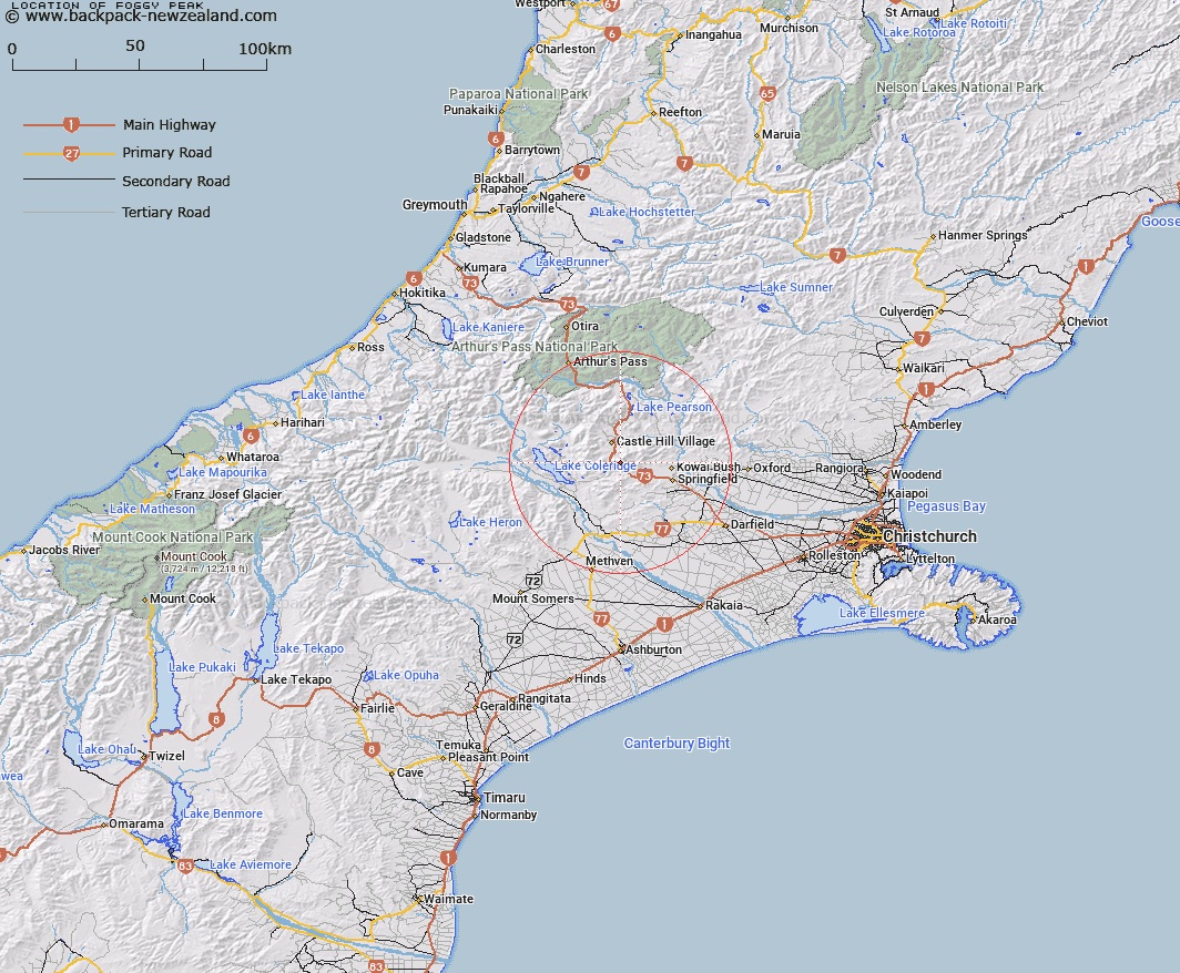
Map showing location of Foggy Peak


LINZ description: Peak at the southern end of Torlesse Range 1741m, 3km South-west of Castle Hill Peak. Kowai Survey District.
Latitude: -43.279204
Longitude: 171.748528
Northing: 5207419.1
Easting: 1498457.2
Land District: Canterbury
Feat Type: Hill


Scroll down to see a more detailed road map and below that a topographical map showing the location of Foggy Peak. The road map has been supplied by openstreetmap and the topographical map of Foggy Peak has been supplied by Land Information New Zealand (LINZ).

Yes you can use the top static map for you school/university project or personal website with a link back. Contact me for any commercial use.

Foggy Peak Map New Zealand


New Zealand places in our database
[ A ] [ B ] [ C ] [ D ] [ E ] [ F ] [ G ] [ H ] [ I ] [ J ] [ K ] [ L ] [ M ] [ N ] [ O ] [ P ] [ Q ] [ R ] [ S ] [ T ] [ U ] [ V ] [ W ] [ X ] [ Y ] [ Z ]


Closest 20 Hills to Foggy Peak

Foggy Peak ( 0km )   Mount Plenty ( 2.82km )   Castle Hill Peak ( 2.92km )   Cloudy Hill ( 5.09km )   Mount Lyndon ( 5.45km )   Red Peak ( 5.49km )   Mount Torlesse ( 6.49km )   Junction Peak ( 6.8km )   Rabbit Hill ( 7.13km )   Castle Hill ( 7.17km )   Prebble Hill ( 7.46km )   Back Peak ( 7.65km )   Gorge Hill ( 8.35km )   Otarama Peak ( 8.5km )   Ben More ( 8.83km )   Leith Hill ( 9.17km )   Blue Hill ( 9.63km )   Carn Brea ( 9.75km )   Red Hill ( 10.01km )   Willis Peak ( 10.28km )   Boundary Hill ( 10.29km )   Caesars Hill ( 10.38km )   Mount Enys ( 10.5km )   Russell Peak ( 10.64km )   Flock Hill ( 11.19km )   Hogs Back ( 11.83km )   Mount Cloudsley ( 11.85km )   Goldney Hill ( 13.24km )   Mount Georgina ( 13.26km )   Mount Izard ( 13.43km )   Laings Hill ( 13.46km )   Broken Hill ( 13.53km )   Bridge Hill ( 14.02km )   Mount Barker ( 14.06km )   Knuckles ( 14.1km )   Bold Hill ( 14.19km )   Big Ben ( 14.23km )   Wether Hills ( 14.81km )   Mount Cheeseman ( 14.84km )   Paterson Hill ( 14.98km )