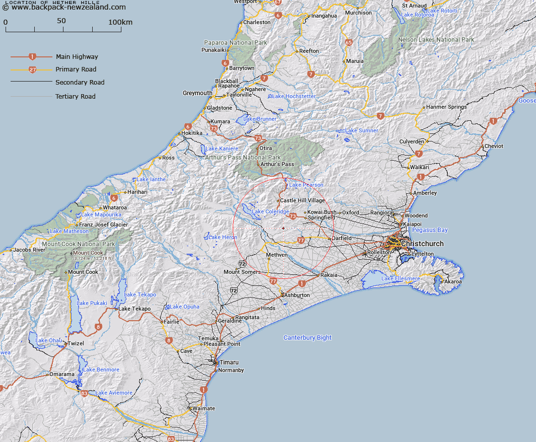
Map showing location of Wether Hills
LINZ description: Low range of hills running North-eastward through Trig. J (Geodetic Code AA4T) between Bush Stream and North Branch, Selwyn River. Block I Hororata and Block XIII Kowai Survey Districts.
Latitude: -43.412268
Longitude: 171.757118
Northing: 5192651.8
Easting: 1499374.2
Land District: Canterbury
Feat Type: Hill
Latitude: -43.412268
Longitude: 171.757118
Northing: 5192651.8
Easting: 1499374.2
Land District: Canterbury
Feat Type: Hill

Scroll down to see a more detailed road map and below that a topographical map showing the location of Wether Hills. The road map has been supplied by openstreetmap and the topographical map of Wether Hills has been supplied by Land Information New Zealand (LINZ).
Yes you can use the top static map for you school/university project or personal website with a link back. Contact me for any commercial use.
[ A ] [ B ] [ C ] [ D ] [ E ] [ F ] [ G ] [ H ] [ I ] [ J ] [ K ] [ L ] [ M ] [ N ] [ O ] [ P ] [ Q ] [ R ] [ S ] [ T ] [ U ] [ V ] [ W ] [ X ] [ Y ] [ Z ]