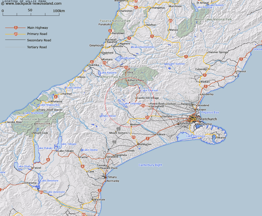
Map showing location of Willis Peak
LINZ description: A peak at 1962m at the southern end of Craigieburn Range, approximately 85km west-northwest of Christchurch. Feature shown on: NZTopo50-BW20 882080
Latitude: -43.272661
Longitude: 171.621803
Northing: 5207983.8
Easting: 1488162.8
Land District: Canterbury
Feat Type: Hill
Latitude: -43.272661
Longitude: 171.621803
Northing: 5207983.8
Easting: 1488162.8
Land District: Canterbury
Feat Type: Hill

Scroll down to see a more detailed road map and below that a topographical map showing the location of Willis Peak. The road map has been supplied by openstreetmap and the topographical map of Willis Peak has been supplied by Land Information New Zealand (LINZ).
Yes you can use the top static map for you school/university project or personal website with a link back. Contact me for any commercial use.
[ A ] [ B ] [ C ] [ D ] [ E ] [ F ] [ G ] [ H ] [ I ] [ J ] [ K ] [ L ] [ M ] [ N ] [ O ] [ P ] [ Q ] [ R ] [ S ] [ T ] [ U ] [ V ] [ W ] [ X ] [ Y ] [ Z ]