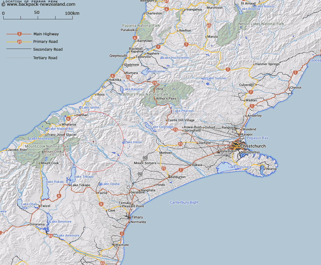
Map showing location of Ferrar Peak


LINZ description: At 2225m south west of Cloudy Peak Range
Latitude: -43.47008
Longitude: 170.785755
Northing: 5184600
Easting: 1420900
Land District: Canterbury
Feat Type: Hill


Scroll down to see a more detailed road map and below that a topographical map showing the location of Ferrar Peak. The road map has been supplied by openstreetmap and the topographical map of Ferrar Peak has been supplied by Land Information New Zealand (LINZ).

Yes you can use the top static map for you school/university project or personal website with a link back. Contact me for any commercial use.

Ferrar Peak Map New Zealand


New Zealand places in our database
[ A ] [ B ] [ C ] [ D ] [ E ] [ F ] [ G ] [ H ] [ I ] [ J ] [ K ] [ L ] [ M ] [ N ] [ O ] [ P ] [ Q ] [ R ] [ S ] [ T ] [ U ] [ V ] [ W ] [ X ] [ Y ] [ Z ]


Closest 20 Hills to Ferrar Peak

Cloudy Peak ( 1.13km )   Mount Nolan ( 1.49km )   Mount Onslow ( 2.13km )   Mount McRae ( 6.47km )   Watchdog Peak ( 6.55km )   Mount Caroline ( 7.63km )   Finlay Hill ( 8.63km )   Mount Jollie ( 9.18km )   Mount McMillan ( 9.26km )   Alma ( 10.56km )   The Sentinel ( 10.81km )   Black Mountain ( 11.46km )   Low Peak ( 11.5km )   Oklahoma ( 11.61km )   Exeter Peak ( 11.61km )   Mount Potts ( 11.78km )   Achilles Peak ( 11.85km )   Tauroa Peak ( 11.95km )   Johnstone Mount ( 12km )   Bandit Peak ( 12.04km )   High Peak ( 12.07km )   Graf Spee ( 12.1km )   Mount Sunday ( 12.29km )   Helmet Peak ( 12.67km )   Myrmidon ( 12.76km )   Trireme Peak ( 12.77km )   East Sentinel ( 12.9km )   Milne Peak ( 13.09km )   Veil Peak ( 13.2km )   Priam ( 13.24km )   The Pyramid ( 13.29km )   Amazon Peak ( 13.67km )   Tantalus ( 13.85km )   Sword Peak ( 13.93km )   Pyramus Peak ( 14.12km )   McClure Peak ( 14.39km )   The Thumbs ( 14.48km )   Dolphin Peak ( 14.55km )   Rankin Peak ( 14.63km )   Eric Twins ( 14.65km )