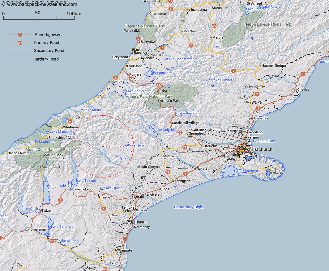
Map showing location of Mount Caroline


LINZ description: Peak above Clyde River, approximately 1.5km North-east of Trig. M (Geodetic Code AA6Q). Block XI Clyde Survey District.
Latitude: -43.489141
Longitude: 170.876661
Northing: 5182674.6
Easting: 1428307.2
Land District: Canterbury
Feat Type: Hill


Scroll down to see a more detailed road map and below that a topographical map showing the location of Mount Caroline. The road map has been supplied by openstreetmap and the topographical map of Mount Caroline has been supplied by Land Information New Zealand (LINZ).

Yes you can use the top static map for you school/university project or personal website with a link back. Contact me for any commercial use.

Mount Caroline Map New Zealand


New Zealand places in our database
[ A ] [ B ] [ C ] [ D ] [ E ] [ F ] [ G ] [ H ] [ I ] [ J ] [ K ] [ L ] [ M ] [ N ] [ O ] [ P ] [ Q ] [ R ] [ S ] [ T ] [ U ] [ V ] [ W ] [ X ] [ Y ] [ Z ]


Closest 20 Hills to Mount Caroline

Mount Potts ( 4.15km )   The Pyramid ( 5.87km )   Mount Nolan ( 6.28km )   Mount Sunday ( 6.72km )   Mount McRae ( 6.79km )   Ferrar Peak ( 7.63km )   Cloudy Peak ( 8.44km )   Mount Onslow ( 8.82km )   Mount Jollie ( 9.33km )   Black Mountain ( 10.35km )   Pito Peak ( 11.43km )   Watchdog Peak ( 12.17km )   Johnstone Mount ( 12.73km )   Harpers Knob ( 12.85km )   South Peak ( 13.31km )   Red Mountain ( 13.81km )   Hakatere Peak ( 13.84km )   Mount Brabazon ( 13.86km )   The Sentinel ( 13.94km )   Alma ( 14.1km )   Bandit Peak ( 14.39km )   Low Peak ( 14.54km )   Ashburton Peak ( 14.85km )   Achilles Peak ( 14.87km )   High Peak ( 15.17km )   Amazon Peak ( 15.26km )   Outlaw Peak ( 15.27km )   Mount Renegade ( 15.76km )   Myrmidon ( 15.85km )   Finlay Hill ( 15.87km )   Exeter Peak ( 15.99km )   Hells Gates ( 16.01km )   Wild Mans Hill ( 16.11km )   Priam ( 16.2km )   Warrior Peak ( 16.22km )   The Warrior ( 16.22km )   Nym Peak ( 16.58km )   The Thumbs ( 16.71km )   Spearpoint Peak ( 16.79km )   Mount Arrowsmith ( 16.81km )