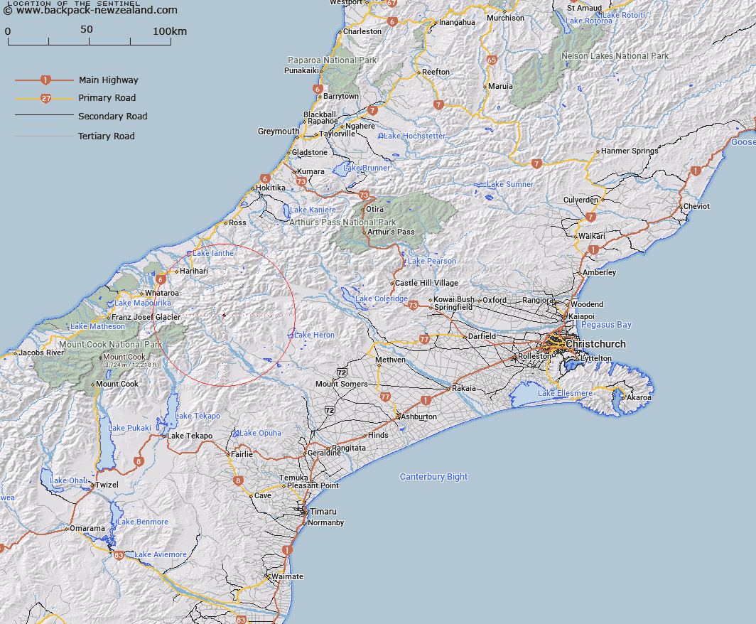
Map showing location of The Sentinel


LINZ description: On a subsidiary range of the Armoury Range
Latitude: -43.374161
Longitude: 170.807764
Northing: 5195300
Easting: 1422400
Land District: Canterbury
Feat Type: Hill


Scroll down to see a more detailed road map and below that a topographical map showing the location of The Sentinel. The road map has been supplied by openstreetmap and the topographical map of The Sentinel has been supplied by Land Information New Zealand (LINZ).

Yes you can use the top static map for you school/university project or personal website with a link back. Contact me for any commercial use.

The Sentinel Map New Zealand


New Zealand places in our database
[ A ] [ B ] [ C ] [ D ] [ E ] [ F ] [ G ] [ H ] [ I ] [ J ] [ K ] [ L ] [ M ] [ N ] [ O ] [ P ] [ Q ] [ R ] [ S ] [ T ] [ U ] [ V ] [ W ] [ X ] [ Y ] [ Z ]


Closest 20 Hills to The Sentinel

Bandit Peak ( 1.64km )   Amazon Peak ( 3.56km )   Scimitar Peak ( 3.91km )   Johnstone Mount ( 4.01km )   The Warrior ( 4.36km )   Warrior Peak ( 4.36km )   Nym Peak ( 4.62km )   Spearpoint Peak ( 4.67km )   Bardolph Peak ( 5.08km )   Watchdog Peak ( 5.28km )   Pistol Peak ( 5.37km )   Mount Jollie ( 5.41km )   Outlaw Peak ( 5.62km )   View Peak ( 5.94km )   Review Peak ( 6.02km )   Mount Renegade ( 6.03km )   Nicholson Peak ( 6.47km )   Mount Goethe ( 6.54km )   Tauroa Peak ( 6.58km )   Mount McRae ( 7.17km )   Trireme Peak ( 7.58km )   Prelude Peak ( 7.97km )   Quoin Peak ( 8.17km )   Snowy Peak ( 8.28km )   Malcolm Peak ( 8.31km )   Baker Peak ( 8.4km )   Helmet Peak ( 8.52km )   Schrund Peak ( 8.55km )   Hells Gates ( 8.82km )   Mount Onslow ( 8.85km )   Outram Peak ( 9.11km )   Mount Tyndall ( 9.19km )   Veil Peak ( 9.36km )   Mount Stoddart ( 9.75km )   Newton Peak ( 9.76km )   Hidden Peak ( 9.89km )   Cloudy Peak ( 9.92km )   Jollie Sisters Peaks ( 10.03km )   Jollie Sisters ( 10.13km )   Mount Nolan ( 10.52km )