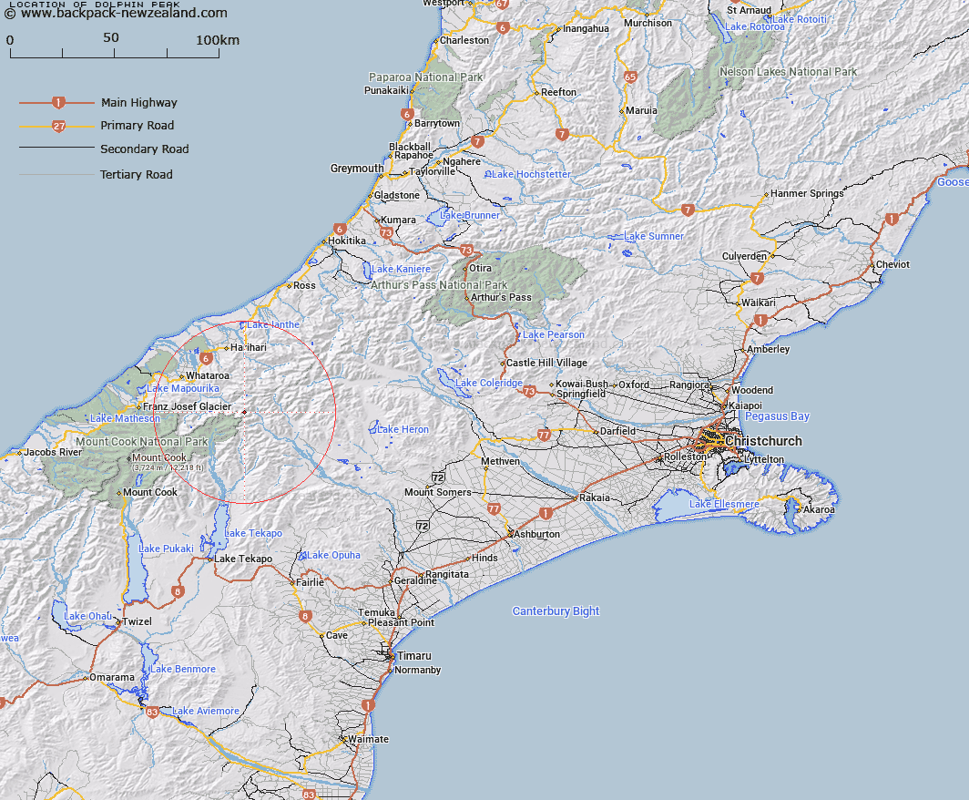
Map showing location of Dolphin Peak


LINZ description: On Main Divide between Eric Twins and Dennistoun Pass. Block I Torlesse SD and Block XI Tyndall SD.
Latitude: -43.40714
Longitude: 170.627735
Northing: 5191238.1
Easting: 1407919
Land District: Canterbury, Westland
Feat Type: Hill


Scroll down to see a more detailed road map and below that a topographical map showing the location of Dolphin Peak. The road map has been supplied by openstreetmap and the topographical map of Dolphin Peak has been supplied by Land Information New Zealand (LINZ).

Yes you can use the top static map for you school/university project or personal website with a link back. Contact me for any commercial use.

Dolphin Peak Map New Zealand


New Zealand places in our database
[ A ] [ B ] [ C ] [ D ] [ E ] [ F ] [ G ] [ H ] [ I ] [ J ] [ K ] [ L ] [ M ] [ N ] [ O ] [ P ] [ Q ] [ R ] [ S ] [ T ] [ U ] [ V ] [ W ] [ X ] [ Y ] [ Z ]


Closest 20 Hills to Dolphin Peak

Eric Twins ( 1.04km )   Mount Odell ( 1.7km )   McClure Peak ( 2.93km )   Milne Peak ( 3.15km )   Sword Peak ( 3.32km )   Mount Shyness ( 3.94km )   Pyramus Peak ( 3.98km )   Dennistoun Peak ( 4.04km )   Rankin Peak ( 4.06km )   Mount Edison ( 4.24km )   Oklahoma ( 4.24km )   Malthus Peak ( 4.28km )   Mount Petermann ( 5.18km )   The Commander ( 5.24km )   Mount McMillan ( 5.41km )   Veil Peak ( 6.44km )   The Onlooker ( 6.91km )   Helmet Peak ( 7.1km )   Mount Ariki ( 7.16km )   Sceptre Peak ( 7.2km )   Mount Moreton ( 7.39km )   Mount D'Archiac ( 7.42km )   McKinnon Peak ( 7.65km )   Cumine Peak ( 7.93km )   Mount Coates ( 8.19km )   Trireme Peak ( 8.27km )   Gorrie Peak ( 8.37km )   Mount Earle ( 8.69km )   Mount Rangatira ( 8.75km )   Mount Kennedy ( 8.8km )   Mount Wolseley ( 8.8km )   Mount Victoire ( 8.83km )   Little Unknown ( 8.88km )   The Great Unknown ( 8.89km )   Tauroa Peak ( 8.89km )   The Great Unknown Peak ( 8.9km )   White Pyramid ( 9.06km )   Outram Peak ( 9.06km )   Mount Walton ( 9.1km )   East Sentinel ( 9.35km )