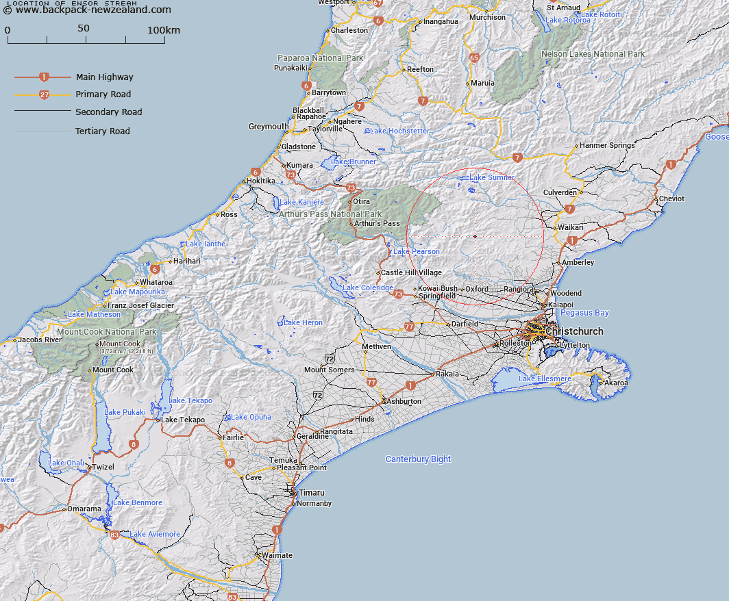
Map showing location of Ensor Stream


LINZ description: Left bank tributary of Punanui Stream, rising 300m West of Mount Gordon [Trig. F (Geodetic Code A9E5)], flowing southwards and joining Punanui Stream 1.8km north-west of Spring Hill [Trig. X (Geodetic Code A9U1)]. Block XIII Okuku Survey District.
Latitude: -43.01198
Longitude: 172.260089
Northing: 5237589.3
Easting: 1539702.7
Land District: Canterbury
Feat Type: Stream


Scroll down to see a more detailed road map and below that a topographical map showing the location of Ensor Stream. The road map has been supplied by openstreetmap and the topographical map of Ensor Stream has been supplied by Land Information New Zealand (LINZ).

Yes you can use the top static map for you school/university project or personal website with a link back. Contact me for any commercial use.

Ensor Stream Map New Zealand


New Zealand places in our database
[ A ] [ B ] [ C ] [ D ] [ E ] [ F ] [ G ] [ H ] [ I ] [ J ] [ K ] [ L ] [ M ] [ N ] [ O ] [ P ] [ Q ] [ R ] [ S ] [ T ] [ U ] [ V ] [ W ] [ X ] [ Y ] [ Z ]


Closest 20 Streams to Ensor Stream

Fraser Stream ( 1.29km )   Punanui Stream ( 1.34km )   Stockyard Stream ( 2.47km )   Den Stream ( 2.78km )   Okuku River ( 2.86km )   Duncan Stream ( 3.83km )   Panhandle Stream ( 4.47km )   Firewood Stream ( 5.47km )   Pancake Stream ( 5.65km )   Laurie Stream ( 6.27km )   Long Spur Stream ( 6.28km )   Okuku Downs Stream ( 7.37km )   Retreat Creek ( 7.6km )   Youngman Stream ( 7.72km )   Whistling Creek ( 8.36km )   Whitnow Stream ( 8.79km )   Duck Creek ( 9.09km )   Lilburne River ( 9.85km )   Lillburn River ( 9.85km )   Grant Stream ( 10.32km )   Retreat Stream ( 10.4km )   Leaseman Stream ( 11.14km )   Deadwood Stream ( 11.21km )   Okuku River South Branch ( 11.5km )   Pig Spur Stream ( 11.52km )   Boundary Stream ( 12.07km )   Hut Branch ( 12.57km )   Bridge Creek ( 12.62km )   Chinsurah Stream ( 12.69km )   Tapley Stream ( 13.04km )   Cattlepeak Stream ( 13.26km )   Waterfall Stream ( 13.29km )   Pember Stream ( 13.53km )   Esk River ( 14.05km )   Seaward River ( 14.06km )   Ribbonwood Stream ( 14.06km )   Broom Stream ( 14.32km )   Rocky Stream ( 14.4km )   Kingsdown Stream ( 14.63km )   Blue Mountain Stream ( 14.84km )