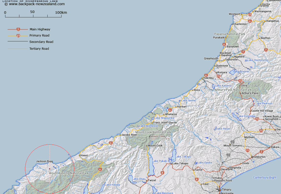
Map showing location of Disappearing Lake


LINZ description: Small Lake from which Laschelles Creek flows (outlet underground) south of McArthur Tops.
Latitude: -44.079505
Longitude: 168.576226
Northing: 5109774.5
Easting: 1245790.2
Land District: Westland
Feat Type: Lake


Scroll down to see a more detailed road map and below that a topographical map showing the location of Disappearing Lake. The road map has been supplied by openstreetmap and the topographical map of Disappearing Lake has been supplied by Land Information New Zealand (LINZ).

Yes you can use the top static map for you school/university project or personal website with a link back. Contact me for any commercial use.

Disappearing Lake Map New Zealand


New Zealand places in our database
[ A ] [ B ] [ C ] [ D ] [ E ] [ F ] [ G ] [ H ] [ I ] [ J ] [ K ] [ L ] [ M ] [ N ] [ O ] [ P ] [ Q ] [ R ] [ S ] [ T ] [ U ] [ V ] [ W ] [ X ] [ Y ] [ Z ]


Closest 20 Lakes to Disappearing Lake

Lake Ellery ( 7.03km )   Smiths Ponds ( 7.87km )   Lake Hamer ( 8.07km )   Lake Leeb ( 9.76km )   Lake Dan ( 10.15km )   Delta Tarn ( 10.76km )   Lake Porm ( 11.34km )   Lake Bux ( 11.59km )   Lake Mary ( 11.62km )   Woodhen Pond ( 13.19km )   Lake Jumbuck ( 15.59km )   Lake Greaney ( 16.71km )   Theta Tarn ( 17.26km )   Minim Mere ( 17.35km )   Lake Nisson ( 18.58km )   Charlies Ponds ( 19.77km )   Waiatoto Lagoon ( 21.47km )   Cloudmaker Lake ( 27.64km )   Lucidus Lake ( 31.08km )   Lucidus Lake ( 31.41km )   Lake Castalia ( 31.57km )   Lake Diana ( 31.95km )   Macs Lagoon ( 32.49km )   Boil Hole ( 35.63km )   Crucible Lake ( 35.72km )   Crescent Lake ( 38.54km )   Lake Williamson ( 39.1km )   Lake Douglas ( 42.95km )   Waiuna Lagoon ( 42.96km )   Lake Wilmot ( 44.43km )   Lake Eggeling ( 46.73km )   Tawharekiri Lakes ( 49.89km )   Lake Never ( 52.59km )   Fohn Lakes ( 54.47km )   Lake Barra ( 56.18km )   McKenzie Lagoon ( 56.77km )   Lochnagar ( 56.8km )   Lake Speden ( 58.25km )   Lake Mystery ( 58.32km )   Lake McKerrow/Whakatipu Waitai ( 58.36km )