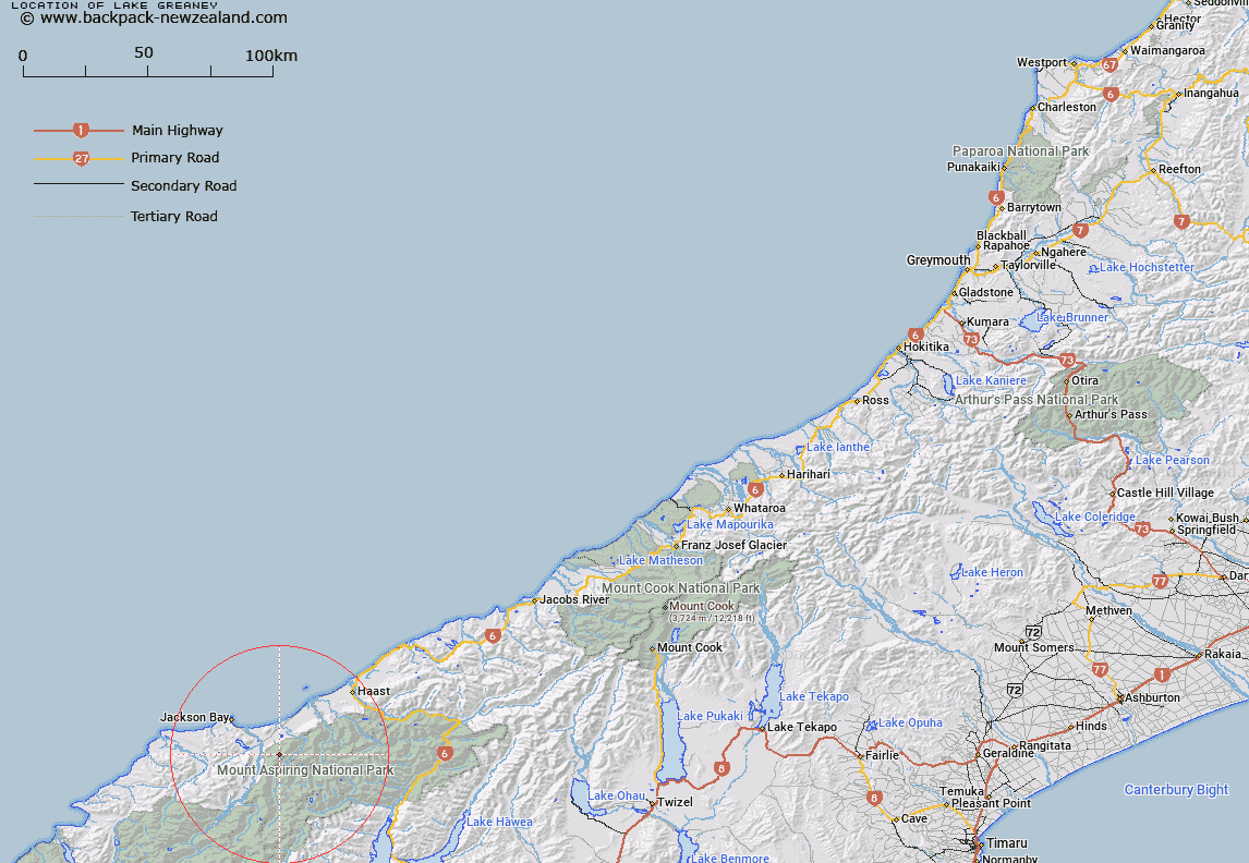
Map showing location of Lake Greaney


LINZ description: Lake immediately below and to the East of Mount Heveldt, and 800m south-west of Minim Mere. Arawata Survey District.
Latitude: -44.09324
Longitude: 168.784562
Northing: 5109125.4
Easting: 1262550.8
Land District: Westland
Feat Type: Lake


Scroll down to see a more detailed road map and below that a topographical map showing the location of Lake Greaney. The road map has been supplied by openstreetmap and the topographical map of Lake Greaney has been supplied by Land Information New Zealand (LINZ).

Yes you can use the top static map for you school/university project or personal website with a link back. Contact me for any commercial use.

Lake Greaney Map New Zealand


New Zealand places in our database
[ A ] [ B ] [ C ] [ D ] [ E ] [ F ] [ G ] [ H ] [ I ] [ J ] [ K ] [ L ] [ M ] [ N ] [ O ] [ P ] [ Q ] [ R ] [ S ] [ T ] [ U ] [ V ] [ W ] [ X ] [ Y ] [ Z ]


Closest 20 Lakes to Lake Greaney

Minim Mere ( 1.22km )   Charlies Ponds ( 4.4km )   Lake Nisson ( 7.91km )   Lake Mary ( 8.2km )   Lake Leeb ( 10.54km )   Lake Dan ( 10.95km )   Lake Ellery ( 11.22km )   Lake Porm ( 12.45km )   Lake Bux ( 12.49km )   Waiatoto Lagoon ( 13.14km )   Disappearing Lake ( 16.71km )   Lake Castalia ( 17.85km )   Lucidus Lake ( 18.42km )   Lucidus Lake ( 18.8km )   Crucible Lake ( 19.67km )   Lake Diana ( 20.04km )   Lake Hamer ( 21.73km )   Macs Lagoon ( 21.78km )   Smiths Ponds ( 22.1km )   Boil Hole ( 22.18km )   Cloudmaker Lake ( 24.12km )   Delta Tarn ( 25.7km )   Woodhen Pond ( 25.82km )   Lake Douglas ( 28.17km )   Theta Tarn ( 29.65km )   Lake Eggeling ( 31.27km )   Lake Jumbuck ( 31.99km )   Tawharekiri Lakes ( 38.43km )   Lake Barra ( 40.37km )   Lake Williamson ( 46.5km )   Crescent Lake ( 47.86km )   Lake Dime ( 49.45km )   Lake Law ( 50.05km )   The Neck Lagoon ( 50.08km )   Lake Wanaka ( 55.34km )   Oanaka ( 55.34km )   Lake Topsy ( 55.44km )   Lake Wilmot ( 55.7km )   Arethusa Pool ( 56.48km )   Lake Moeraki ( 56.57km )