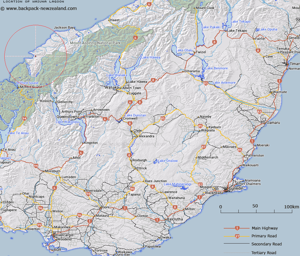
Map showing location of Waiuna Lagoon


LINZ description: Lagoon near the mouth of Dry Awarua River just inland from Big Bay.
Latitude: -44.3045
Longitude: 168.138238
Northing: 5082800
Easting: 1212200
Land District: Otago
Feat Type: Lake


Scroll down to see a more detailed road map and below that a topographical map showing the location of Waiuna Lagoon. The road map has been supplied by openstreetmap and the topographical map of Waiuna Lagoon has been supplied by Land Information New Zealand (LINZ).

Yes you can use the top static map for you school/university project or personal website with a link back. Contact me for any commercial use.

Waiuna Lagoon Map New Zealand


New Zealand places in our database
[ A ] [ B ] [ C ] [ D ] [ E ] [ F ] [ G ] [ H ] [ I ] [ J ] [ K ] [ L ] [ M ] [ N ] [ O ] [ P ] [ Q ] [ R ] [ S ] [ T ] [ U ] [ V ] [ W ] [ X ] [ Y ] [ Z ]


Closest 20 Lakes to Waiuna Lagoon

Lake Wilmot ( 10.74km )   McKenzie Lagoon ( 13.81km )   Lake McKerrow/Whakatipu Waitai ( 17.52km )   Lake McKerrow ( 17.52km )   Crescent Lake ( 18.02km )   Lake Speden ( 21.69km )   Lake Never ( 21.79km )   Lake Williamson ( 23.72km )   Lake Alabaster/W?w?hi Waka ( 23.85km )   Lake Alabaster ( 23.85km )   Lake Mantle ( 24.26km )   Fohn Lakes ( 25.41km )   Theta Tarn ( 26.97km )   Lake Truth ( 27.72km )   Lake Agnes ( 30.67km )   Woodhen Pond ( 30.89km )   Lake Never-never ( 31.67km )   Lake Iceberg ( 31.71km )   Pukutahi Lake ( 31.97km )   Delta Tarn ( 32.2km )   Lake Mystery ( 32.26km )   Smiths Ponds ( 35.41km )   Lake Hamer ( 35.51km )   Lake Jumbuck ( 36.85km )   Nerine Lake ( 37.12km )   Lake Unknown ( 37.82km )   Lake Hyslop ( 38.48km )   Lake Turner ( 39.81km )   Disappearing Lake ( 42.96km )   Rainbow Lake ( 42.98km )   Lake Porm ( 44.58km )   Lake Bux ( 44.6km )   Lake Wilson ( 44.7km )   Lake Dan ( 45.75km )   Lake Leeb ( 46.11km )   Cloudmaker Lake ( 46.38km )   Lake Silvan ( 46.77km )   Lake Sylvan ( 46.77km )   Lake Harris ( 46.89km )   Lake Adelaide ( 47.01km )