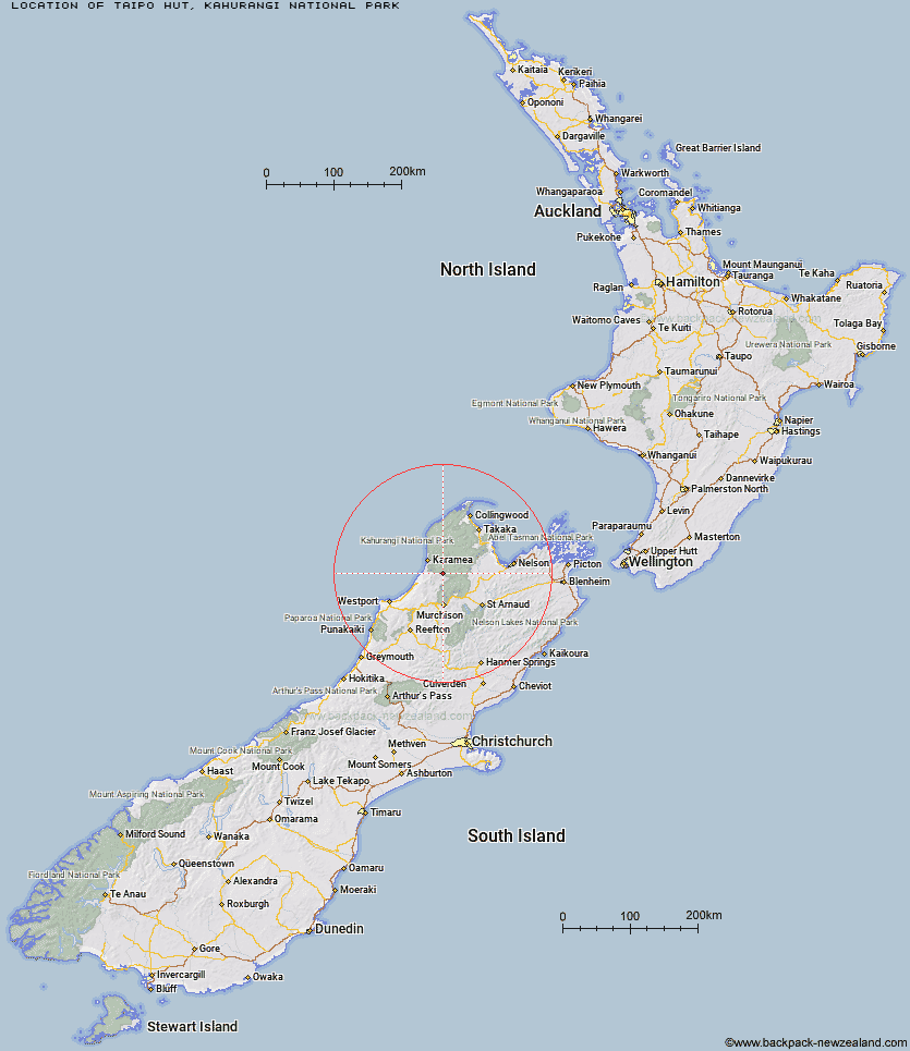
Topo Map showing location of Taipo Hut
This information is sourced from DoC, LINZ and Openstreetmap. Some of the hut photos are mine and the rest are from DoC. I will be adding an upload feature soon so people can photos of .Taipo Hut.
Basic info: standard 16-bunk hut in the Motueka area.
Latitude: -41.397944808
Longitude: 172.313698468
Location: Kahurangi National Park
KAHURANGI NATIONAL PARK Type of Hut: Standard
Tracks: Wangapeka Track
Map: BQ23 Topo Map | Road Map
Does this hut still exist? Have any more information? Contact
Basic info: standard 16-bunk hut in the Motueka area.
Latitude: -41.397944808
Longitude: 172.313698468
Location: Kahurangi National Park
KAHURANGI NATIONAL PARK Type of Hut: Standard
Tracks: Wangapeka Track
Map: BQ23 Topo Map | Road Map
Does this hut still exist? Have any more information? Contact
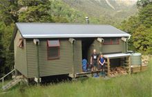
Image: DoC
Scroll down to see a topographical map and road map showing the location of Taipo Hut
[ A ] [ B ] [ C ] [ D ] [ E ] [ F ] [ G ] [ H ] [ I ] [ J ] [ K ] [ L ] [ M ] [ N ] [ O ] [ P ] [ Q ] [ R ] [ S ] [ T ] [ U ] [ V ] [ W ] [ Y ] [ Z ]
Closest 20 Huts to Taipo Hut
These are as the crow fliesStag Flat Shelter 1.52km Wangapeka Bivouac 3.67km Helicopter Flat Hut 4.43km Trevor Carter Hut 6.39km Kākāpō Hut 7.33km Johnson Hut 8.33km Belltown Manunui Hut 8.35km Stone Hut 10.78km Thor Hut 11.5km Hurricane Hut 13.4km Venus Hut 13.84km Kiwi Saddle Hut 15.12km Cecil Kings Hut 15.8km Kings Creek Hut 15.86km Crow Hut 17.39km Greys Hut 17.94km Larrikin Creek Hut 18.01km John Reid Hut 19.68km Mokihinui Forks Hut 20.14km Specimen Point Hut 21.15km McConchies Hut 21.49km Branch Creek Hut 21.59km Adams Flat Hut 23.84km Poor Pete's Hut 24.04km Roaring Lion Hut 24.39km Karamea Bend Hut 24.65km Granity Pass Hut 24.87km Goat Creek Hut 25.02km Sunshine Flat Shelter 26.79km Flanagans Hut 27.08km Lake Matiri Hut 28.73km Stern Valley Hut 31.06km Splugeons Rock Shelter 32.64km Ellis Hut 35.82km Ghost Lake Hut 35.97km Balloon Hut 36.24km Kohaihai Shelter 36.63km Dry Rock Shelter 37.92km Trilobite Hut 38.68km Myttons Hut 38.89km