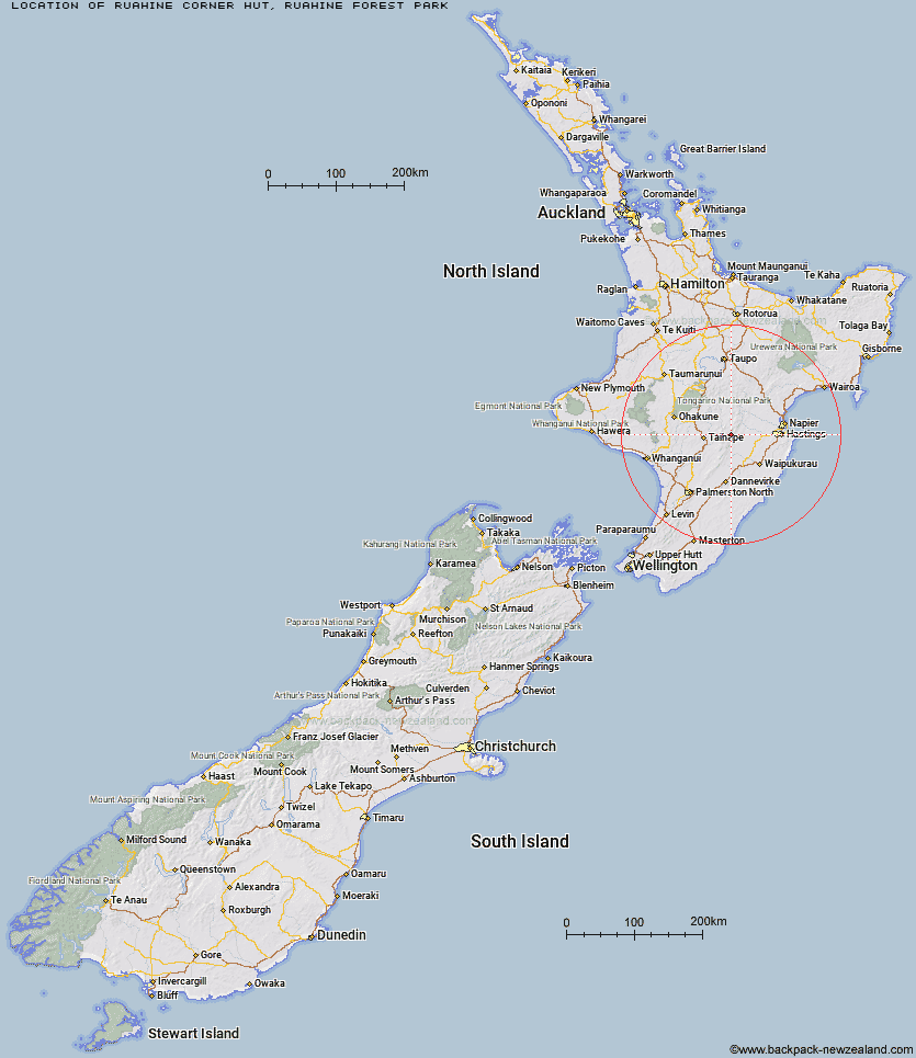
Topo Map showing location of Ruahine Corner Hut
This information is sourced from DoC, LINZ and Openstreetmap. Some of the hut photos are mine and the rest are from DoC. I will be adding an upload feature soon so people can photos of .Ruahine Corner Hut.
Basic info: standard six-bunk hut in the Manawatu region.
Latitude: -39.6312552522
Longitude: 176.171856245
Location: Ruahine Forest Park
Area: Manawatu/Whanganui
Type of Hut: Standard
Tracks: Ruahine Corner to Rangitane Road
Map: BK36 Topo Map | Road Map
Does this hut still exist? Have any more information? Contact
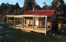
Image: DoC
Scroll down to see a topographical map and road map showing the location of Ruahine Corner Hut
[ A ] [ B ] [ C ] [ D ] [ E ] [ F ] [ G ] [ H ] [ I ] [ J ] [ K ] [ L ] [ M ] [ N ] [ O ] [ P ] [ Q ] [ R ] [ S ] [ T ] [ U ] [ V ] [ W ] [ Y ] [ Z ]
Closest 20 Huts to Ruahine Corner Hut
These are as the crow fliesRockslide Hut 4.94km Ikawetea Forks Hut 5.05km Colenso Hut 5.22km Kylie Bivouac 5.89km Makirikiri Hut 6.96km Aranga Hut 7km Mistake Bivouac 7.02km Upper Makaroro Hut 7.28km Parks Peak Hut 8.48km Iron Bark Hut 8.8km No Mans Hut 9.33km Barlow Hut 9.87km Sentry Box Hut 10.24km Otukota Hut 10.89km Maropea Forks Hut 11.32km Sparrowhawk Bivouac 11.89km Dead Dog Hut 12.29km Masters Shelter 12.82km Taruarau Bivouac 12.97km Ellis Hut 13.14km Dianes Hut 13.75km Wakelings Hut 14.18km Tin Hut 14.62km Gold Creek Hut 14.68km Herricks Hut 14.73km Briens Hut 14.98km Ruahine Hut 15.5km Cedars Hut (Blowfly) 15.79km Top Maropea Hut 15.97km Poutaki Hut 16.27km Norris Hut 16.33km Crow Hut 16.81km Shutes Hut 16.84km Sunrise Hut 17.38km McKinnon Hut 17.98km Kawhatau Base 18.1km Triplex Hut 18.17km Waipawa Forks Hut 18.63km Waikamaka Hut 20.31km Comet Hut 20.74km