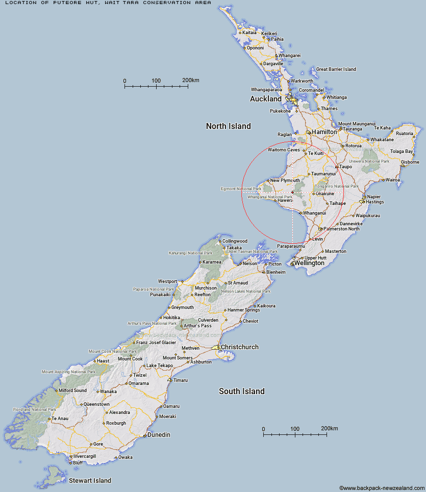
Topo Map showing location of Puteore Hut
This information is sourced from DoC, LINZ and Openstreetmap. Some of the hut photos are mine and the rest are from DoC. I will be adding an upload feature soon so people can photos of .Puteore Hut.
Basic info: standard six-bunk hut in the Whanganui region.
Latitude: -39.3694239074
Longitude: 174.789687243
Location: WaitÅtara Conservation Area
Area: Manawatu/Whanganui
Type of Hut: Standard
Map: BJ31 Topo Map | Road Map
Does this hut still exist? Have any more information? Contact
Basic info: standard six-bunk hut in the Whanganui region.
Latitude: -39.3694239074
Longitude: 174.789687243
Location: WaitÅtara Conservation Area
Area: Manawatu/Whanganui
Type of Hut: Standard
Map: BJ31 Topo Map | Road Map
Does this hut still exist? Have any more information? Contact
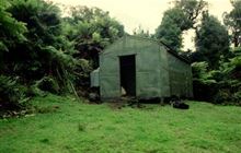
Image: DoC
Scroll down to see a topographical map and road map showing the location of Puteore Hut
[ A ] [ B ] [ C ] [ D ] [ E ] [ F ] [ G ] [ H ] [ I ] [ J ] [ K ] [ L ] [ M ] [ N ] [ O ] [ P ] [ Q ] [ R ] [ S ] [ T ] [ U ] [ V ] [ W ] [ Y ] [ Z ]
Closest 20 Huts to Puteore Hut
These are as the crow fliesPouri Hut 6.38km Tahupo Hut 7.2km Omaru Hut 9.41km Ngapurua Hut 10.21km Trains Hut 13.27km Puketotara Hut 16.22km Tieke Kainga 17.85km John Coull Hut 18.5km Ohuraiti Hut 40.88km Rerekapa Hut 48.74km Downes hut 49.33km Waingongoro Hut 58.68km Maketawa Hut 60.2km Hooker Shelter 60.64km Mangaturuturu Hut 61.77km Kaiauai Shelter 62.35km Syme Hut 62.59km Lake Dive Hut 62.79km Lupton Hut 63.11km Blyth Hut 63.37km Whakapapaiti Hut 64.33km Holly Hut 64.89km Mangaehuehu Hut 65.44km Pouakai Hut 66.42km Kahui Hut 67.19km Waiaua Gorge Hut 67.76km Ten Man Hut 68.95km Whangaehu Hut 69.4km Rangipo Hut 72.15km Waiweranui Trust Hut 72.4km Mangatepopo Hut 73.84km Old Waihohonu Hut 78.04km Waihohonu Hut 78.64km Ketetahi Shelter 79.83km Oturere Hut 80.91km Zekes Hut 84.37km Westlawn Hut 92.16km Hauhungaroa Hut 93.31km Bob's Hut 102.61km Waihaha Hut 102.62km