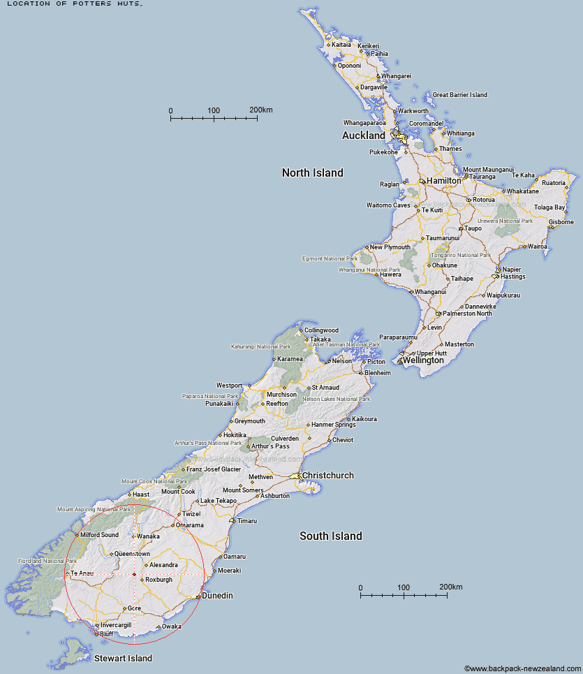
Topo Map showing location of Potters Huts
This information is sourced from DoC, LINZ and Openstreetmap. Some of the hut photos are mine and the rest are from DoC. I will be adding an upload feature soon so people can photos of .Potters Huts.
Latitude: -45.4269121096
Longitude: 169.144381024
Location:
Type of Hut:
Map: Topo Map | Road Map
Does this hut still exist? Have any more information? Contact
Latitude: -45.4269121096
Longitude: 169.144381024
Location:
Type of Hut:
Map: Topo Map | Road Map
Does this hut still exist? Have any more information? Contact
Scroll down to see a topographical map and road map showing the location of Potters Huts
[ A ] [ B ] [ C ] [ D ] [ E ] [ F ] [ G ] [ H ] [ I ] [ J ] [ K ] [ L ] [ M ] [ N ] [ O ] [ P ] [ Q ] [ R ] [ S ] [ T ] [ U ] [ V ] [ W ] [ Y ] [ Z ]
Closest 20 Huts to Potters Huts
These are as the crow fliesAndrew Rees Hut 0.44km Diggers Hut 5.54km McCrimmons Hut 6.06km Christies Hut 8.24km Nicholsons Hut 8.85km Bush Huts 9.76km Junction Hut 9.81km Boundary Hut 10.79km Blue Lake Huts 17.11km Whites Hut 18.11km Titan Huts 18.68km Black Hut 22.7km Baileys Hut 23.23km Junction Hut 24.29km Stronach Hut 24.57km Old Woman Hut 25.01km Flaxy Hut 25.56km Dome Hut 30.3km Garston Ski Hut 31.06km Slate Hut 31.08km Mud Hut 32.3km Hyde Home Hut 34.19km Jim Baird Hut 35.82km Cairnmuir Musterer's Hut 35.99km Sullivan Hut 36.54km Leithen Hut 37.51km Two Mile Hut 38.75km Beaumont Hut 40.28km Mitchells Hut 41.87km Glen Roy Raceman's Hut 43.29km Ross Hut 45.1km Siberia Hut 46.5km Long Burn Hut 48.21km Canadian Hut 50.79km Deep Creek Hut 52.27km Cowshed Hut 52.87km Billy Hut 53.51km Saint Marys Hut 54.97km Shepherd Creek Hut 55.66km The Swamp Hut 56.64km