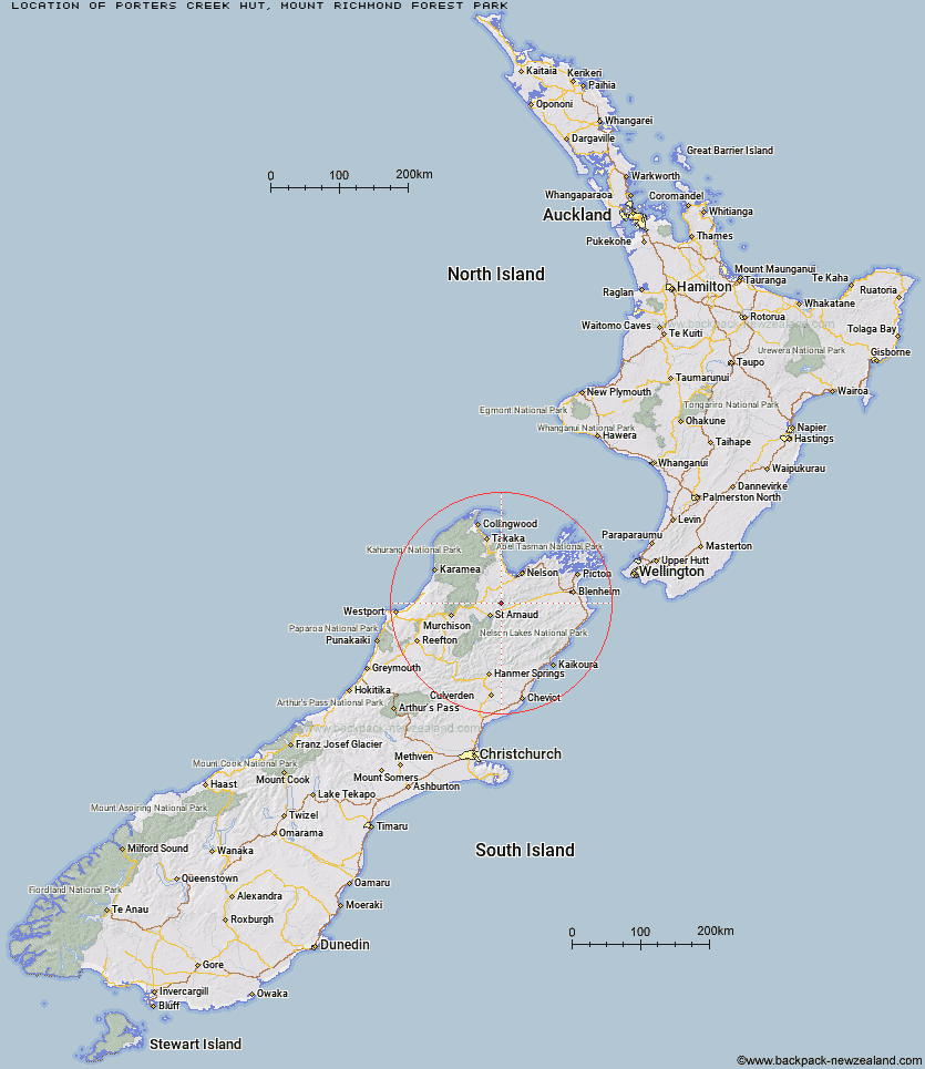
Topo Map showing location of Porters Creek Hut
This information is sourced from DoC, LINZ and Openstreetmap. Some of the hut photos are mine and the rest are from DoC. I will be adding an upload feature soon so people can photos of .Porters Creek Hut.
Basic info: standard 6-bunk hut in the Motueka area.
Latitude: -41.6536191675
Longitude: 172.997301659
Location: Mount Richmond Forest Park
Area: Nelson/Tasman
Type of Hut: Standard
Map: BR25 Topo Map | Road Map
Does this hut still exist? Have any more information? Contact
Basic info: standard 6-bunk hut in the Motueka area.
Latitude: -41.6536191675
Longitude: 172.997301659
Location: Mount Richmond Forest Park
Area: Nelson/Tasman
Type of Hut: Standard
Map: BR25 Topo Map | Road Map
Does this hut still exist? Have any more information? Contact
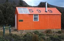
Image: DoC
Scroll down to see a topographical map and road map showing the location of Porters Creek Hut
[ A ] [ B ] [ C ] [ D ] [ E ] [ F ] [ G ] [ H ] [ I ] [ J ] [ K ] [ L ] [ M ] [ N ] [ O ] [ P ] [ Q ] [ R ] [ S ] [ T ] [ U ] [ V ] [ W ] [ Y ] [ Z ]
Closest 20 Huts to Porters Creek Hut
These are as the crow fliesPorters Creek Hut 0km Hunters Hut 6.03km Top Wairoa Hut 8.05km Red Hills Hut 8.64km Beebys Hut 9.14km Mid Wairoa Hut 13.83km Lower Goulter Hut 15.54km Silverstream Bivouac 16.03km Tarn Hut 18.16km Mid Silverstream Hut 19.53km Bull Paddock Creek Hut 19.9km Mid Goulter Hut 21.4km Greigs Hut 22.23km Caves Hut 23.33km Lost Stream Bivouac 23.67km Mt Rintoul Hut 23.84km Bushline Hut 24.97km Bushedge Shelter 25.12km Relax Shelter 25.5km Top Misery Hut 25.63km Siberia Hut 25.91km Boulder Forks Hut 26.18km Hidden Hut 26.57km Old Man Hut 26.9km Barbers Hut 27.34km Coldwater Hut 28.37km Lake Chalice Hut 28.49km Lakehead Hut 28.65km Turkeys Nest Bivouac 28.88km Bottom Misery Hut 28.99km Starveall Hut 29.78km Slaty Hut 29.94km Speargrass Hut 29.99km Gosling Hut 31.38km Lees Creek Hut 32.26km Bottom Gordons Hut 32.6km Angelus Hut 33.27km Hacket Hut 33.56km Branch Bivouac 34.63km Top Gordon Hut 35.01km