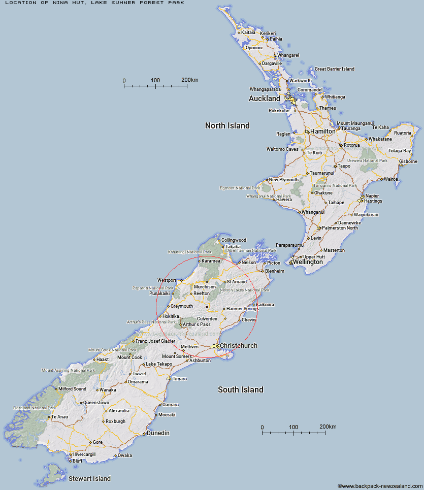
Topo Map showing location of Nina Hut
This information is sourced from DoC, LINZ and Openstreetmap. Some of the hut photos are mine and the rest are from DoC. I will be adding an upload feature soon so people can photos of .Nina Hut.
Basic info: This accessible hut is a good overnight option for families with children who have some tramping experience or new trampers.
Latitude: -42.4658237055
Longitude: 172.322156574
Location: Lake Sumner Forest Park
Area: Canterbury
Type of Hut: Standard
Tracks: Nina valley tracks and routes
Map: BT23 Topo Map | Road Map
Does this hut still exist? Have any more information? Contact
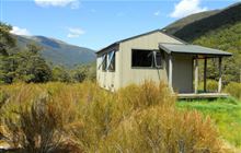
Image: DoC
Scroll down to see a topographical map and road map showing the location of Nina Hut
[ A ] [ B ] [ C ] [ D ] [ E ] [ F ] [ G ] [ H ] [ I ] [ J ] [ K ] [ L ] [ M ] [ N ] [ O ] [ P ] [ Q ] [ R ] [ S ] [ T ] [ U ] [ V ] [ W ] [ Y ] [ Z ]
Closest 20 Huts to Nina Hut
These are as the crow fliesDevils Den Bivouac 3.34km Upper Nina Bivouac 4.13km Lucretia Hut 4.82km Brass Monkey Bivouac 5.18km Lake Christabel Hut 6.35km Doubtful Hut 7.93km Doubtless Hut 10.06km Boyle Flat Hut 11.36km Top Robinson Hut 11.8km Rokeby Hut 12.14km Lake Man Bivouac 12.21km Magdalen Hut 13km Bus Shelter 14.04km Pell Stream Hut 15.72km Hope Halfway Hut 16.79km Saint Jacob's Hut 16.99km Carlyle Hut 17.05km Cannibal Gorge Hut 17.83km Manson-Nicholls Memorial Hut 18.09km Top Hope Hut 18.28km Museum Hut 19.11km Steyning Hut 19.35km Mid Robinson Hut 19.87km Anne Cullers Hut 20.13km Tin Jug Hut 20.68km Ada Pass Hut 21.09km Anne Hut 21.23km Slaty Creek Hut 21.37km Jervois Hut 21.74km Evangeline Bivouac 24.35km Tutu Hut 25.13km Stony Stream Bivouac 25.13km Three Mile Stream Hut 25.26km Pool Hut 25.31km Old Bridge Hut 25.43km Scotties Hut 26.38km Glenrae Bivouac 27.3km Christopher Hut 28.05km Christopher Cullers Hut 28.06km Jollie Brook Hut 28.27km