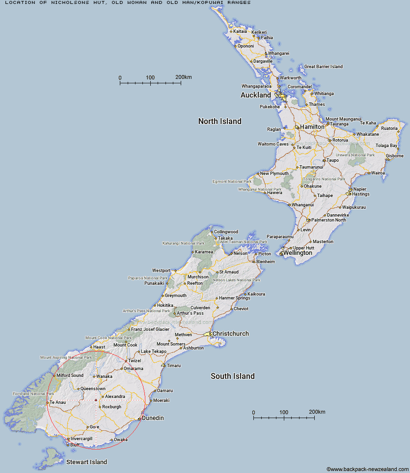
Topo Map showing location of Nicholsons Hut
This information is sourced from DoC, LINZ and Openstreetmap. Some of the hut photos are mine and the rest are from DoC. I will be adding an upload feature soon so people can photos of .Nicholsons Hut.
Basic info: basic five-bunk hut in the Central Otago area.
Latitude: -45.3529478456
Longitude: 169.18617186
Location: Old Woman and Old Man/Kopuwai Ranges
Area: Otago
Type of Hut: Basic/bivvies
Map: CD31 Topo Map | Road Map
Does this hut still exist? Have any more information? Contact
Basic info: basic five-bunk hut in the Central Otago area.
Latitude: -45.3529478456
Longitude: 169.18617186
Location: Old Woman and Old Man/Kopuwai Ranges
Area: Otago
Type of Hut: Basic/bivvies
Map: CD31 Topo Map | Road Map
Does this hut still exist? Have any more information? Contact
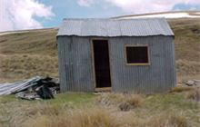
Image: DoC
Scroll down to see a topographical map and road map showing the location of Nicholsons Hut
[ A ] [ B ] [ C ] [ D ] [ E ] [ F ] [ G ] [ H ] [ I ] [ J ] [ K ] [ L ] [ M ] [ N ] [ O ] [ P ] [ Q ] [ R ] [ S ] [ T ] [ U ] [ V ] [ W ] [ Y ] [ Z ]
Closest 20 Huts to Nicholsons Hut
These are as the crow fliesBoundary Hut 4.1km Diggers Hut 6.84km Potters Huts 8.85km Andrew Rees Hut 8.88km McCrimmons Hut 9.17km Whites Hut 10.66km Christies Hut 17.08km Junction Hut 17.54km Bush Huts 18.14km Old Woman Hut 18.48km Baileys Hut 22.72km Blue Lake Huts 23.93km Titan Huts 27.02km Cairnmuir Musterer's Hut 27.31km Black Hut 31.54km Junction Hut 32.22km Stronach Hut 33.42km Flaxy Hut 33.53km Two Mile Hut 35.98km Garston Ski Hut 36km Slate Hut 36.4km Dome Hut 37.45km Mud Hut 37.87km Glen Roy Raceman's Hut 38.31km Hyde Home Hut 42.28km Mitchells Hut 43.51km Jim Baird Hut 43.62km Deep Creek Hut 44.31km Sullivan Hut 44.57km Leithen Hut 46.23km Ross Hut 46.32km Siberia Hut 46.86km Long Burn Hut 47.03km Beaumont Hut 48.85km Meg Hut 49.64km Canadian Hut 49.87km Kirtle Burn Hut 53.63km Billy Hut 54.59km Robrosa Hut 55.14km Saint Marys Hut 55.58km