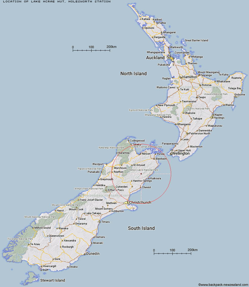
Topo Map showing location of Lake McRae Hut
This information is sourced from DoC, LINZ and Openstreetmap. Some of the hut photos are mine and the rest are from DoC. I will be adding an upload feature soon so people can photos of .Lake McRae Hut.
Basic info: standard 6-bunk hut in the South Marlborough area.
Latitude: -42.1875872478
Longitude: 173.313596808
Location: Molesworth Station
Area: Marlborough
Type of Hut: Standard
Map: BT26 Topo Map | Road Map
Does this hut still exist? Have any more information? Contact
Basic info: standard 6-bunk hut in the South Marlborough area.
Latitude: -42.1875872478
Longitude: 173.313596808
Location: Molesworth Station
Area: Marlborough
Type of Hut: Standard
Map: BT26 Topo Map | Road Map
Does this hut still exist? Have any more information? Contact
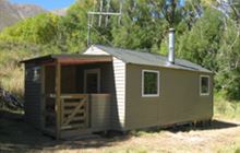
Image: DoC
Scroll down to see a topographical map and road map showing the location of Lake McRae Hut
[ A ] [ B ] [ C ] [ D ] [ E ] [ F ] [ G ] [ H ] [ I ] [ J ] [ K ] [ L ] [ M ] [ N ] [ O ] [ P ] [ Q ] [ R ] [ S ] [ T ] [ U ] [ V ] [ W ] [ Y ] [ Z ]
Closest 20 Huts to Lake McRae Hut
These are as the crow fliesSeymour Hut 7.98km Palmer Hut 12.24km Black Spur Historic Hut 13.54km Warden Hut 14.43km Alfred Hut 15.55km Tent Poles Hut 15.87km Carters Yards Hut 16.62km Kahutara Bivouac 16.76km Palmer Bivouac 17.23km Half Moon Hut 17.53km Limestone Hut 17.75km Acheron Hut 17.87km Junction Hut 19.31km Munroe Hut 19.47km Saxton Hut 19.82km Goose Flat Hut 19.98km Dubious Bivouac 20.77km Guide Hut 21.59km Team Hut 22.06km Red Gate Hut 22.35km Cloudy Hut 24.22km Burnt Yards Hut 24.84km Stone Jug Hut 25.34km Fidgit Bivouac 26.09km Kowhai Hut 26.24km Severn Hut 26.77km Mt Fyffe Hut 27.58km Yarra Hut 28.42km Hapuku Hut 29.38km Old Middlehurst Hut 29.96km Top Gordon Hut 30.08km Barratts Bivouac 30.17km Barratts Hut 30.18km Ravine Hut 30.2km Top Leatham Hut 30.56km Bottom Gordons Hut 32.35km Haycocks Bivouac 32.68km Branch Bivouac 33.78km Sedgemere Sleepout 34.59km Jam Hut 34.65km