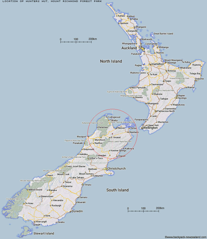
Topo Map showing location of Hunters Hut
This information is sourced from DoC, LINZ and Openstreetmap. Some of the hut photos are mine and the rest are from DoC. I will be adding an upload feature soon so people can photos of .Hunters Hut.
Basic info: standard 8-bunk hut in the Motueka area.
Latitude: -41.5995409508
Longitude: 173.002989144
Location: Mount Richmond Forest Park
Area: Nelson/Tasman
Type of Hut: Standard
Map: BR25 Topo Map | Road Map
Does this hut still exist? Have any more information? Contact
Basic info: standard 8-bunk hut in the Motueka area.
Latitude: -41.5995409508
Longitude: 173.002989144
Location: Mount Richmond Forest Park
Area: Nelson/Tasman
Type of Hut: Standard
Map: BR25 Topo Map | Road Map
Does this hut still exist? Have any more information? Contact
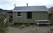
Image: DoC
Scroll down to see a topographical map and road map showing the location of Hunters Hut
[ A ] [ B ] [ C ] [ D ] [ E ] [ F ] [ G ] [ H ] [ I ] [ J ] [ K ] [ L ] [ M ] [ N ] [ O ] [ P ] [ Q ] [ R ] [ S ] [ T ] [ U ] [ V ] [ W ] [ Y ] [ Z ]
Closest 20 Huts to Hunters Hut
These are as the crow fliesPorters Creek Hut 6.03km Top Wairoa Hut 6.15km Mid Wairoa Hut 10.36km Lower Goulter Hut 14.46km Beebys Hut 14.59km Red Hills Hut 14.67km Tarn Hut 14.72km Mid Goulter Hut 19.45km Mt Rintoul Hut 20.19km Silverstream Bivouac 21.85km Old Man Hut 23.8km Starveall Hut 25.35km Mid Silverstream Hut 25.36km Bull Paddock Creek Hut 25.92km Slaty Hut 26.2km Lake Chalice Hut 26.62km Greigs Hut 27.69km Caves Hut 27.75km Hacket Hut 28.74km Hidden Hut 28.89km Lost Stream Bivouac 29.63km Boulder Forks Hut 29.74km Bushline Hut 30.31km Bushedge Shelter 30.33km Relax Shelter 30.73km Browning Hut 30.76km Turkeys Nest Bivouac 31.16km Top Misery Hut 31.65km Siberia Hut 31.68km Barbers Hut 32.43km Coldwater Hut 33.84km Gosling Hut 33.89km Lakehead Hut 34.17km Richmond Saddle Hut 34.6km Bottom Misery Hut 34.89km Speargrass Hut 34.94km Roebuck Hut 36.13km Mt Fell Hut 37.73km Granity Pass Hut 37.73km Bottom Gordons Hut 38.13km