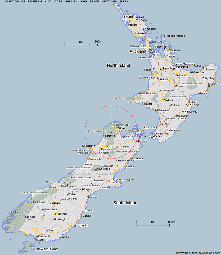
Topo Map showing location of Fenella Hut
This information is sourced from DoC, LINZ and Openstreetmap. Some of the hut photos are mine and the rest are from DoC. I will be adding an upload feature soon so people can photos of .Fenella Hut.
Basic info: serviced 12-bunk hut in the Golden Bay area.
Latitude: -41.0496025591
Longitude: 172.525196898
Location: Cobb Valley, Kahurangi National Park
Area: Nelson/Tasman
Type of Hut: Serviced
Tracks: Cobb valley tracks
Map: BP23 Topo Map | Road Map
Does this hut still exist? Have any more information? Contact
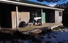
Image: DoC
Scroll down to see a topographical map and road map showing the location of Fenella Hut
[ A ] [ B ] [ C ] [ D ] [ E ] [ F ] [ G ] [ H ] [ I ] [ J ] [ K ] [ L ] [ M ] [ N ] [ O ] [ P ] [ Q ] [ R ] [ S ] [ T ] [ U ] [ V ] [ W ] [ Y ] [ Z ]
Closest 20 Huts to Fenella Hut
These are as the crow fliesCobb Hut 0.7km Tent Camp 2.06km Chaffey Hut 6.31km Soper Shelter 7.7km Lonely Lake Hut 7.94km Trilobite Hut 11.4km Sylvester Hut 11.79km Adelaide Tarn Hut 11.99km Waingaro Forks Hut 12.5km Myttons Hut 12.54km Anatoki Forks Hut 14.11km Balloon Hut 15.59km Asbestos Cottage 16.57km Boulder Lake Hut 17.24km Growler Rock Shelter 18.1km Roaring Lion Hut 18.19km Dry Rock Shelter 18.19km Riordans Hut 18.25km Splugeons Rock Shelter 18.67km Perry Saddle Hut 19.44km Upper Gridiron Hut and Rock Shelters 19.68km Tin Hut Shelter 20.04km Karamea Bend Hut 20.44km Flora Hut 22.65km Gouland Downs Hut 22.83km Mt Arthur Hut 22.93km Brown Hut 23.1km Ellis Hut 24.87km Flanagans Hut 25.31km Saxon Hut 25.72km Crow Hut 27.52km Greys Hut 29.67km Sunshine Flat Shelter 30.41km Venus Hut 30.57km Adams Flat Hut 30.92km James Mackay Hut 31.63km Ministry of Works Historic Hut 33.1km Lewis Hut 33.93km Thor Hut 34.51km Katipo Creek Shelter 35.08km