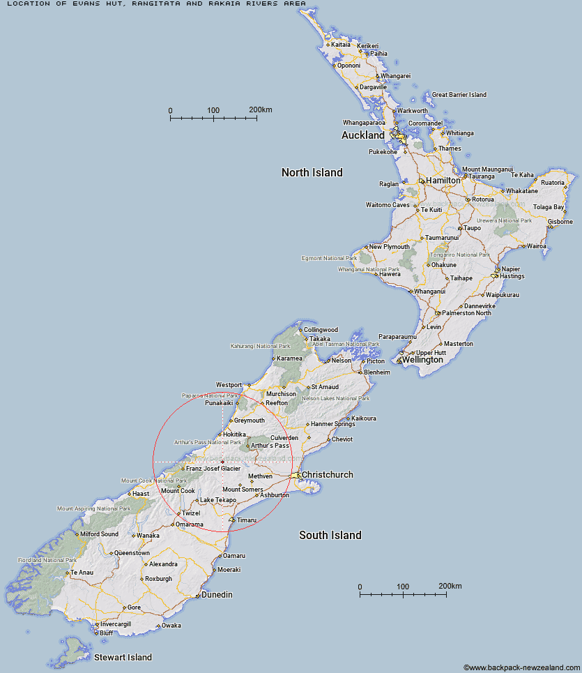
Topo Map showing location of Evans Hut
This information is sourced from DoC, LINZ and Openstreetmap. Some of the hut photos are mine and the rest are from DoC. I will be adding an upload feature soon so people can photos of .Evans Hut.
Basic info: basic six-bunk hut in the Mid and South Canterbury area.
Latitude: -43.2596780319
Longitude: 171.03089152
Location: Rangitata and Rakaia Rivers area
Area: Canterbury
Type of Hut: Basic/bivvies
Map: BW18 Topo Map | Road Map
Does this hut still exist? Have any more information? Contact
Basic info: basic six-bunk hut in the Mid and South Canterbury area.
Latitude: -43.2596780319
Longitude: 171.03089152
Location: Rangitata and Rakaia Rivers area
Area: Canterbury
Type of Hut: Basic/bivvies
Map: BW18 Topo Map | Road Map
Does this hut still exist? Have any more information? Contact
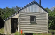
Image: DoC
Scroll down to see a topographical map and road map showing the location of Evans Hut
[ A ] [ B ] [ C ] [ D ] [ E ] [ F ] [ G ] [ H ] [ I ] [ J ] [ K ] [ L ] [ M ] [ N ] [ O ] [ P ] [ Q ] [ R ] [ S ] [ T ] [ U ] [ V ] [ W ] [ Y ] [ Z ]
Closest 20 Huts to Evans Hut
These are as the crow fliesWashbourne Hut 2.01km Banfield Hut 4.77km Lauper Bivouac 5.41km Reischek Hut 5.86km Thompsons Hut 7.16km Jellicoe Hut 7.2km Neave Hut 9.63km Lyell Hut 10.75km Downs Hut 11.1km West Mathias Bivouac 11.4km Mathias Hut 11.46km Centennial Cabin 11.55km Wilkinson Hut 11.92km Cameron Hut 11.99km Moraine Hut 12.64km Lawrence Bivouac 13.43km Price Basin Hut 15.32km Smyth Hut 15.79km Price Flat Hut 16.74km Ivory Lake Hut 16.79km Price Flat Hut 16.94km Highland Home 17.62km Top Hut 17.91km Charlies Hut 17.95km County Stream Hut 18.51km Hermitage Hut 18.65km Top Waitaha Hut 18.98km Canyon Creek Bivouac 19.65km Frew Saddle Bivouac 20.92km Lawrence Hut 21.49km Top Tuke Hut 22.11km Moonbeam Hut 22.43km Hunters Hut 22.88km Frew Hut 23.39km Moa Stream Hut 23.61km McCoy Hut 24.51km Sir Robert Hut 24.52km Bluff Hut 24.92km Healey Creek Hut 25.24km Erewhon Station Hut 25.54km