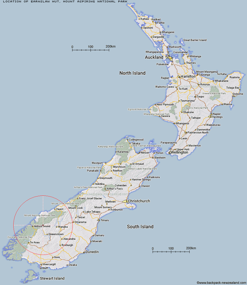
Topo Map showing location of Earnslaw Hut
This information is sourced from DoC, LINZ and Openstreetmap. Some of the hut photos are mine and the rest are from DoC. I will be adding an upload feature soon so people can photos of .Earnslaw Hut.
Basic info: basic four-bunk hut in the Queenstown/Wakatipu area.
Latitude: -44.6217621543
Longitude: 168.447538477
Location: Mount Aspiring National Park
Area: Otago
Type of Hut: Basic/bivvies
Tracks: Kea Basin Track
Map: CA10 Topo Map | Road Map
Does this hut still exist? Have any more information? Contact
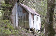
Image: DoC
Scroll down to see a topographical map and road map showing the location of Earnslaw Hut
[ A ] [ B ] [ C ] [ D ] [ E ] [ F ] [ G ] [ H ] [ I ] [ J ] [ K ] [ L ] [ M ] [ N ] [ O ] [ P ] [ Q ] [ R ] [ S ] [ T ] [ U ] [ V ] [ W ] [ Y ] [ Z ]
Closest 20 Huts to Earnslaw Hut
These are as the crow fliesTwenty Five Mile Hut 2.77km Esquilant Bivvy Hut 3.28km Shelter Rock Hut 8.53km Daleys Flat Hut 10.02km Lochnagar Hut 13.94km Dart Hut 13.99km Hundred Mile Hut 16.85km Sixteen Mile Huts 17.02km Routeburn Shelter 17.2km Tummel Burn Hut 18.56km Routeburn Flats Hut 21.69km Ballarat Hut - Flood Burn 21.92km Cascade Hut 22.61km Routeburn Falls Hut 22.78km Routeburn Falls Lodge 22.83km Aspiring Hut 23.29km McIntosh Hut 23.35km Shiel Burn Hut 23.72km McIntyre's Hut 24km Archie's Hut - Copper Creek 24.51km Kay Creek Hut 25.33km Lake Alabaster Hut 25.47km Bullendale Hut 25.67km Jean Hut 25.81km Wallers Hut 25.82km Heather Jock Hut 25.86km Sunshine Hut 26.1km Dynamo Hut 26.21km Polnoon Hut 26.26km Hidden Falls Hut 26.36km Bonnie Jean Hut 26.4km Arawhata Rock Bivouac 26.41km Raspberry Creek Shelter 26.66km Lake Mackenzie Hut 27.04km Olivine Hut 27.11km Lake Mackenzie Lodge 27.14km Liverpool Hut 27.33km Cabin Hut 27.5km Stoney Creek Hut 27.54km Kelly's Hut 27.79km