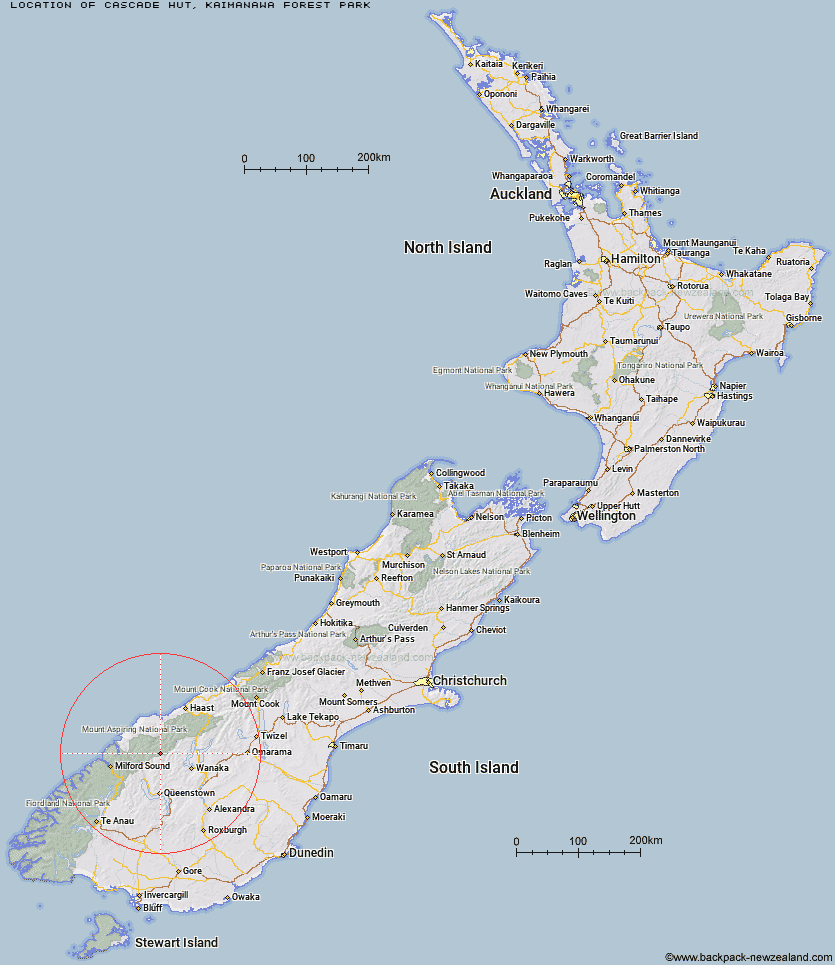
Topo Map showing location of Cascade Hut
This information is sourced from DoC, LINZ and Openstreetmap. Some of the hut photos are mine and the rest are from DoC. I will be adding an upload feature soon so people can photos of .Cascade Hut.
Basic info: This standard six-bunk hut in the Kaimanawa Forest Park is an ideal base for hunters, or for hikers looking to enjoy the scenic Hinemaiaia track.
Latitude: -44.4928742119
Longitude: 168.668260259
Location: Kaimanawa Forest Park
Area: Central North Island
Type of Hut: Standard
Tracks: Boyd, Oamaru and Cascade Hut tracks
Map: BH36 Topo Map | Road Map
Does this hut still exist? Have any more information? Contact
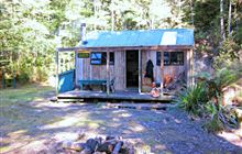
Image: DoC
Scroll down to see a topographical map and road map showing the location of Cascade Hut
[ A ] [ B ] [ C ] [ D ] [ E ] [ F ] [ G ] [ H ] [ I ] [ J ] [ K ] [ L ] [ M ] [ N ] [ O ] [ P ] [ Q ] [ R ] [ S ] [ T ] [ U ] [ V ] [ W ] [ Y ] [ Z ]
Closest 20 Huts to Cascade Hut
These are as the crow fliesAspiring Hut 1.86km Raspberry Creek Shelter 6.67km Liverpool Hut 6.86km French Ridge Hut 7.42km Scotts Rock Bivouac 8.25km Tummel Burn Hut 8.42km Dart Hut 9.57km Arawhata Rock Bivouac 10.02km Lochnagar Hut 12.07km Hundred Mile Hut 12.83km Rock of Ages Bivouac 13.52km Colin Todd Hut 13.6km Shelter Rock Hut 14.6km Black Peak Hut 17.19km Sixteen Mile Huts 20.03km Polnoon Hut 20.24km Shiel Burn Hut 21.58km Earnslaw Hut 22.61km Twenty Five Mile Hut 22.7km Saddle Hut 23.33km Daleys Flat Hut 24.1km Cabin Hut 24.19km Esquilant Bivvy Hut 24.78km Ballarat Hut - Flood Burn 28.72km Top Forks Hut 30.07km Bullendale Hut 32.77km Albert Burn Hut 33.62km Archie's Hut - Copper Creek 33.81km Dynamo Hut 34.3km Olivine Hut 36.47km Fern Burn Hut 37.15km Crystal Hut 37.57km Peats Hut 37.7km Roses Hut 37.91km Highland Creek Hut 38.04km Wanaka Faces Hut 38.05km Sainsburys Huts 39.77km Routeburn Shelter 39.81km Stoney Creek Hut 40.07km Kerin Forks Hut 40.62km