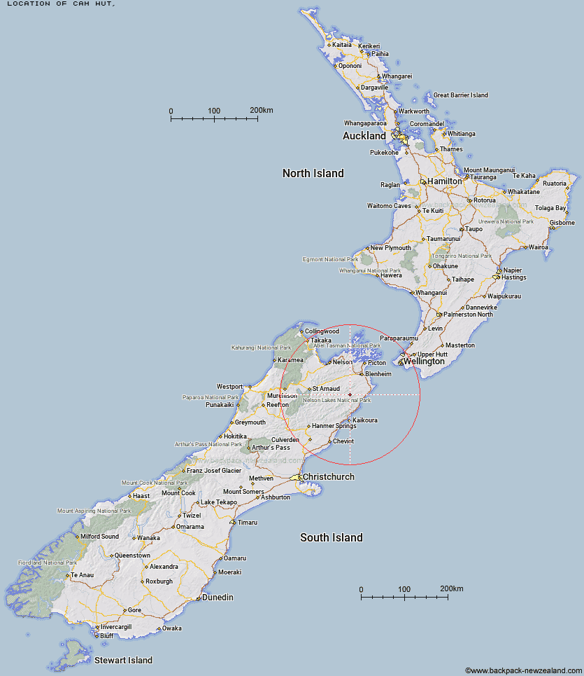
Topo Map showing location of Cam Hut
This information is sourced from DoC, LINZ and Openstreetmap. Some of the hut photos are mine and the rest are from DoC. I will be adding an upload feature soon so people can photos of .Cam Hut.
Latitude: -41.9082733517
Longitude: 173.699915718
Location:
Type of Hut:
Map: Topo Map | Road Map
Does this hut still exist? Have any more information? Contact
Latitude: -41.9082733517
Longitude: 173.699915718
Location:
Type of Hut:
Map: Topo Map | Road Map
Does this hut still exist? Have any more information? Contact
Scroll down to see a topographical map and road map showing the location of Cam Hut
[ A ] [ B ] [ C ] [ D ] [ E ] [ F ] [ G ] [ H ] [ I ] [ J ] [ K ] [ L ] [ M ] [ N ] [ O ] [ P ] [ Q ] [ R ] [ S ] [ T ] [ U ] [ V ] [ W ] [ Y ] [ Z ]
Closest 20 Huts to Cam Hut
These are as the crow fliesFlynns 6.68km Dee Hut 10.91km Mead Hut 11.31km Swale Hut 12.16km Beechs Hut 13.09km Penk Hut 13.56km Gibson Hut 14.46km Cabbage Tree Hut 15.38km Old Middlehurst Hut 16.04km Snowgrass Hut 16.28km Lake Alexander Hut 17.94km Hornby Bivvy 18.11km Zoo Hut 18.89km Whernside Hut 19.06km Ravine Hut 19.58km Jam Hut 20.86km Omaka Bivouac 22.31km Dillon Hut 22.37km Black Birch Bivouac 23.41km Top Whare 23.58km Isolation Hut 23.62km Haycocks Bivouac 23.74km McNaughts Hut 25.24km Beehive Hut 27km Ramshead Hut 28.17km Goose Flat Hut 29.68km Fidgit Bivouac 30.41km Blue Mountain Hut 31.53km Tinpot Hut 33.07km Gosling Hut 33.44km Burnt Yards Hut 33.67km Turkeys Nest Bivouac 36.09km Dubious Bivouac 36.14km Barratts Bivouac 37.36km Barratts Hut 37.47km Hidden Hut 38.37km Munroe Hut 39.03km Boulder Forks Hut 39.18km Limestone Hut 40.44km Hapuku Hut 40.7km