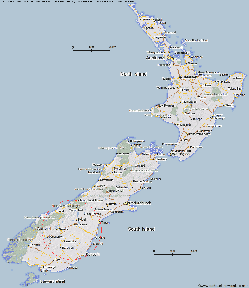
Topo Map showing location of Boundary Creek Hut
This information is sourced from DoC, LINZ and Openstreetmap. Some of the hut photos are mine and the rest are from DoC. I will be adding an upload feature soon so people can photos of .Boundary Creek Hut.
Basic info: Boundary Creek Hut is an 8-bunk hut in the Central Otago area.
Latitude: -44.7287304288
Longitude: 169.85485346
Location: Oteake Conservation Park
Area: Otago
Type of Hut: Standard
Map: CB15 Topo Map | Road Map
Does this hut still exist? Have any more information? Contact
Basic info: Boundary Creek Hut is an 8-bunk hut in the Central Otago area.
Latitude: -44.7287304288
Longitude: 169.85485346
Location: Oteake Conservation Park
Area: Otago
Type of Hut: Standard
Map: CB15 Topo Map | Road Map
Does this hut still exist? Have any more information? Contact
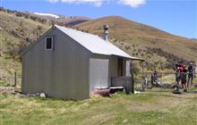
Image: DoC
Scroll down to see a topographical map and road map showing the location of Boundary Creek Hut
[ A ] [ B ] [ C ] [ D ] [ E ] [ F ] [ G ] [ H ] [ I ] [ J ] [ K ] [ L ] [ M ] [ N ] [ O ] [ P ] [ Q ] [ R ] [ S ] [ T ] [ U ] [ V ] [ W ] [ Y ] [ Z ]
Closest 20 Huts to Boundary Creek Hut
These are as the crow fliesTop Hut 7.07km Otamatapaio Hut 12.31km Richmond Hut 14.55km Lauder Basin Hut 20.13km Polson's Hut 20.13km Wire Yards Hut 24.66km Ida Railway Hut 27.34km Chimney Creek Hut 28.1km Tailings Hut 33.63km Burnt Bush Hut 35.11km Hut Creek Hut 35.48km Awakino Ski Field 36.26km Brown Hut 36.9km Buster Hut 38.74km Stodys Hut 39.01km Top Timaru Hut 40.1km Pakituhi Hut 42.67km Mae West Bivouac 43.35km Moonlight & Roses Hut 44.47km Junction Hut 44.69km Hideaway Hut 44.75km Bush Hut 47.26km Pearson Hut 47.52km Cotters Hut 48.75km Ben Avon Hut 50.43km Snowy Gorge Hut 51.11km Robrosa Hut 54.45km Ahuriri Base Hut 54.68km Top Dingle Hut 55.18km Kirtle Burn Hut 57.01km Maitland Hut 57.63km High Burn Hut 58.61km Sawyer Burn Hut 58.77km Wanaka Faces Hut 60.24km Green Bush Hut 60.61km Shamrock Hut 60.86km Little Boundary Hut 61.9km Crumb Hut 62.16km Boundary Hut 62.39km Balmoral Huts 62.98km