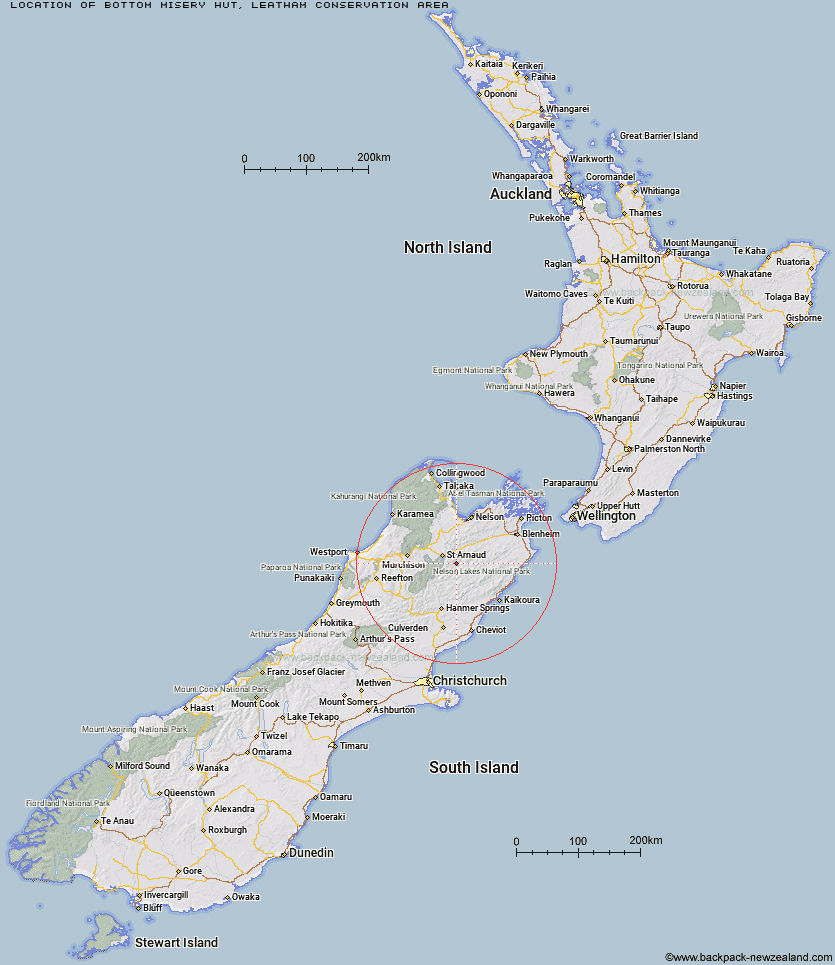
Topo Map showing location of Bottom Misery Hut
This information is sourced from DoC, LINZ and Openstreetmap. Some of the hut photos are mine and the rest are from DoC. I will be adding an upload feature soon so people can photos of .Bottom Misery Hut.
Basic info: standard 6-bunk hut in the South Marlborough area.
Latitude: -41.9113971987
Longitude: 173.049592246
Location: Leatham Conservation Area
Area: Marlborough
Type of Hut: Standard
Map: BS25 Topo Map | Road Map
Does this hut still exist? Have any more information? Contact
Basic info: standard 6-bunk hut in the South Marlborough area.
Latitude: -41.9113971987
Longitude: 173.049592246
Location: Leatham Conservation Area
Area: Marlborough
Type of Hut: Standard
Map: BS25 Topo Map | Road Map
Does this hut still exist? Have any more information? Contact
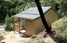
Image: DoC
Scroll down to see a topographical map and road map showing the location of Bottom Misery Hut
[ A ] [ B ] [ C ] [ D ] [ E ] [ F ] [ G ] [ H ] [ I ] [ J ] [ K ] [ L ] [ M ] [ N ] [ O ] [ P ] [ Q ] [ R ] [ S ] [ T ] [ U ] [ V ] [ W ] [ Y ] [ Z ]
Closest 20 Huts to Bottom Misery Hut
These are as the crow fliesBottom Misery Hut 0km Siberia Hut 4.14km Top Misery Hut 5.5km Lost Stream Bivouac 5.5km Branch Bivouac 5.9km Lees Creek Hut 7.13km Top Leatham Hut 7.37km Bottom Gordons Hut 7.63km Greigs Hut 9.5km Mid Silverstream Hut 9.6km Bull Paddock Creek Hut 9.82km Barbers Hut 11.23km Top Gordon Hut 12.26km Silverstream Bivouac 13.08km Team Hut 15.66km Caves Hut 16.48km Severn Hut 16.76km Connors Creek Hut 17.15km Saxton Hut 18.13km Junction Hut 18.7km Lakehead Hut 19.25km Coldwater Hut 19.78km Bushline Hut 20.5km Munroe Hut 20.53km Red Hills Hut 20.61km Carters Yards Hut 21.05km Burnt Yards Hut 21.53km Relax Shelter 21.64km Boulder Forks Hut 21.68km Bushedge Shelter 21.68km Blue Mountain Hut 23.35km Beebys Hut 23.51km Acheron Hut 23.74km John Tait Hut 24.28km Hopeless Hut 24.33km Red Gate Hut 24.58km Begley Hut 24.8km Angelus Hut 25.04km Speargrass Hut 25.48km Cupola Hut 27.05km