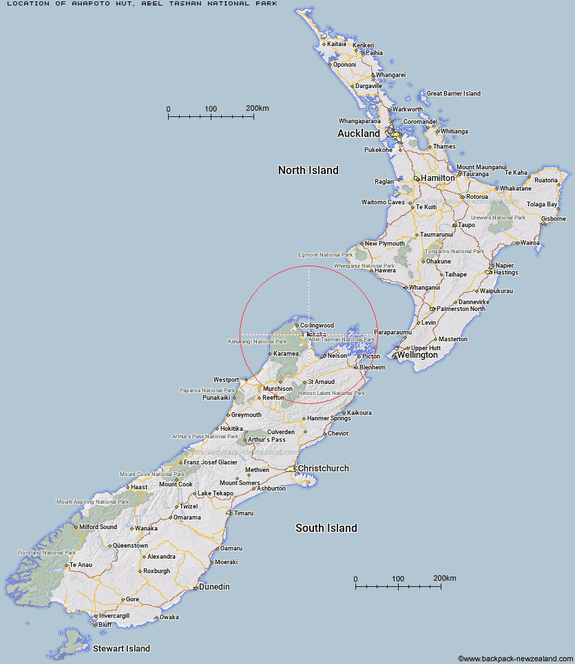
Topo Map showing location of Awapoto Hut
This information is sourced from DoC, LINZ and Openstreetmap. Some of the hut photos are mine and the rest are from DoC. I will be adding an upload feature soon so people can photos of .Awapoto Hut.
Basic info: standard 12-bunk hut in the Golden Bay area.
Latitude: -40.8628093161
Longitude: 172.938801317
Location: Abel Tasman National Park
Area: Nelson/Tasman
Type of Hut: Standard
Tracks: Inland Track
Map: BP25 Topo Map | Road Map
Does this hut still exist? Have any more information? Contact
Basic info: standard 12-bunk hut in the Golden Bay area.
Latitude: -40.8628093161
Longitude: 172.938801317
Location: Abel Tasman National Park
Area: Nelson/Tasman
Type of Hut: Standard
Tracks: Inland Track
Map: BP25 Topo Map | Road Map
Does this hut still exist? Have any more information? Contact
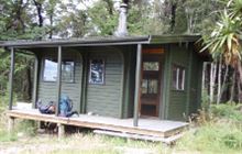
Image: DoC
Scroll down to see a topographical map and road map showing the location of Awapoto Hut
[ A ] [ B ] [ C ] [ D ] [ E ] [ F ] [ G ] [ H ] [ I ] [ J ] [ K ] [ L ] [ M ] [ N ] [ O ] [ P ] [ Q ] [ R ] [ S ] [ T ] [ U ] [ V ] [ W ] [ Y ] [ Z ]
Closest 20 Huts to Awapoto Hut
These are as the crow fliesWainui Hut 5.94km Awaroa Hut 6.63km Moa Park Shelter 8.39km Whariwharangi Hut 8.73km Bark Bay Hut 10.97km Castle Rock Hut 11.06km Holyoake Clearing Shelter 12.44km Anchorage Hut 14.46km Tin Hut Shelter 22.64km Riordans Hut 26.15km Anatoki Forks Hut 29.05km Waingaro Forks Hut 30.11km Boulder Lake Hut 30.54km Soper Shelter 32.86km Adelaide Tarn Hut 34.39km Lonely Lake Hut 34.66km Asbestos Cottage 36.19km Sylvester Hut 36.64km Flora Hut 39.64km Upper Gridiron Hut and Rock Shelters 39.8km Chaffey Hut 40.25km Myttons Hut 40.37km Growler Rock Shelter 40.43km Fenella Hut 40.47km Trilobite Hut 40.62km Tent Camp 40.65km Cobb Hut 40.84km Brown Hut 41.36km Mt Arthur Hut 41.68km Dry Rock Shelter 42.1km Balloon Hut 43.18km Perry Saddle Hut 45.25km Ellis Hut 46.78km Splugeons Rock Shelter 47.09km Gouland Downs Hut 49.32km Saxon Hut 53.09km Flanagans Hut 54.01km Karamea Bend Hut 54.61km Roaring Lion Hut 56.43km Ministry of Works Historic Hut 58.69km