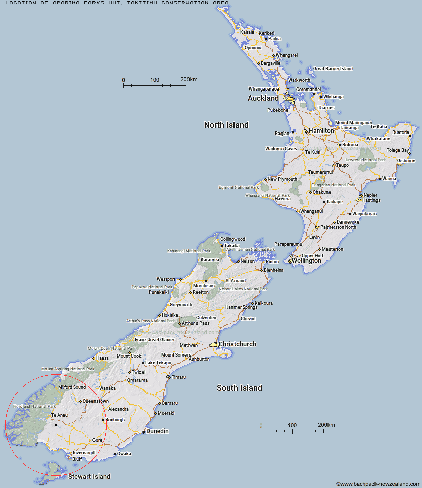
Topo Map showing location of Aparima Forks Hut
This information is sourced from DoC, LINZ and Openstreetmap. Some of the hut photos are mine and the rest are from DoC. I will be adding an upload feature soon so people can photos of .Aparima Forks Hut.
Basic info: basic two-bunk hut in the Southland area.
Latitude: -45.6713112031
Longitude: 167.929958432
Location: Takitimu Conservation Area
Area: Southland
Type of Hut: Basic/bivvies
Tracks: Takitimu Mountains tracks and routes
Map: CE09 Topo Map | Road Map
Does this hut still exist? Have any more information? Contact
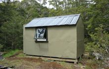
Image: DoC
Scroll down to see a topographical map and road map showing the location of Aparima Forks Hut
[ A ] [ B ] [ C ] [ D ] [ E ] [ F ] [ G ] [ H ] [ I ] [ J ] [ K ] [ L ] [ M ] [ N ] [ O ] [ P ] [ Q ] [ R ] [ S ] [ T ] [ U ] [ V ] [ W ] [ Y ] [ Z ]
Closest 20 Huts to Aparima Forks Hut
These are as the crow fliesAparima Forks Hut 0km Spence Hut 5.5km Upper Princhester Hut 5.59km Becketts Hut 5.95km Aparima Huts 6.7km Upper Wairaki Hut 7.75km Whare Creek Hut 8.07km Lower Princhester Hut 8.8km Redcliff Hut 9.71km Telford Hut 11.12km Cheviot Downs Hut 12.04km Lower Wairaki Hut 12.06km Rock Hut 18.75km Barcoo Hut 21.56km Oreti Hut 26.06km Lower Windley Hut 27.63km Back Valley Hut 28.21km Hope Arm Hut 31.54km Shallow Bay Hut 31.65km Moturau Hut 32.59km North Borland Hut 34.52km Brod Bay Shelter and Campsite 35.7km Upper Windley Hut 35.73km Islands Hut 35.97km Cromel Base Hut 36.16km Kiwi Burn Hut 37.33km Lincoln Hut 37.53km Mt Bee Bunkrooms 38.06km Upper Oreti Hut 39.81km Upper Cromel Hut 39.83km Luxmore Hut 39.97km Cromel Branch Hut 40.06km Ashton Hut 41.4km Forest Burn Shelter 41.95km Mansion Hut 42.93km Green Lake Hut 43.05km Rodger Inlet Huts 43.06km Irthing Hut 43.5km Borland Bivouac 44.04km Hanging Valley Shelter 44.38km