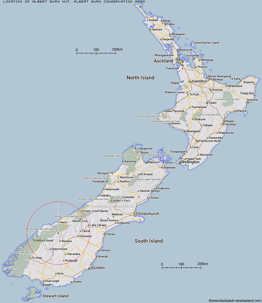
Topo Map showing location of Albert Burn Hut
This information is sourced from DoC, LINZ and Openstreetmap. Some of the hut photos are mine and the rest are from DoC. I will be adding an upload feature soon so people can photos of .Albert Burn Hut.
Basic info: standard eight-bunk hut in the Wanaka/Makarora area.
Latitude: -44.3418636774
Longitude: 169.035026242
Location: Albert Burn Conservation Area
Area: Otago
Type of Hut: Standard
Tracks: Albert Burn Hut Track
Map: BZ12 Topo Map | Road Map
Does this hut still exist? Have any more information? Contact
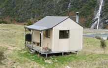
Image: DoC
Scroll down to see a topographical map and road map showing the location of Albert Burn Hut
[ A ] [ B ] [ C ] [ D ] [ E ] [ F ] [ G ] [ H ] [ I ] [ J ] [ K ] [ L ] [ M ] [ N ] [ O ] [ P ] [ Q ] [ R ] [ S ] [ T ] [ U ] [ V ] [ W ] [ Y ] [ Z ]
Closest 20 Huts to Albert Burn Hut
These are as the crow fliesCraigie Burn Hut 10.39km Kerin Forks Hut 11.41km Top Forks Hut 13.69km Siberia Hut 15.39km Young Hut 19.1km Sawyer Burn Hut 19.46km Rock of Ages Bivouac 20.61km Wanaka Faces Hut 23.03km Big Hopwood Burn Hut 23.41km Colin Todd Hut 27.27km Cameron Hut 27.42km French Ridge Hut 28.77km Scotts Rock Bivouac 29.47km Raspberry Creek Shelter 29.73km Liverpool Hut 31.02km High Burn Hut 31.39km Black Peak Hut 32.92km Aspiring Hut 33.36km Junction Hut 33.4km Moonlight & Roses Hut 33.57km Cascade Hut 33.62km Bush Hut 34.74km Saddle Hut 34.75km Arawhata Rock Bivouac 34.86km Franklin Hut 35.12km Little Boundary Hut 35.46km Green Bush Hut 36.06km Boundary Hut 36.14km Mae West Bivouac 36.49km Pakituhi Hut 36.93km Tummel Burn Hut 38.42km Cotters Hut 38.43km Stodys Hut 38.95km Ben Avon Hut 39.64km Top Timaru Hut 39.71km Makarora Hut 40.02km Polnoon Hut 40.74km Brewster Hut 41.25km Hundred Mile Hut 41.99km Top Dingle Hut 42.03km