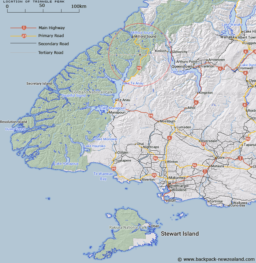
Map showing location of Triangle Peak


LINZ description: In Earl Mountains between Mistake Creek and Hutt Creek, tributaries of Eglinton River. About two and a half miles south of Pyramid Peak. Greenstone Survey District.
Latitude: -44.882284
Longitude: 168.011446
Northing: 5018008
Easting: 1206019.1
Land District: Southland
Feat Type: Hill


Scroll down to see a more detailed road map and below that a topographical map showing the location of Triangle Peak. The road map has been supplied by openstreetmap and the topographical map of Triangle Peak has been supplied by Land Information New Zealand (LINZ).

Yes you can use the top static map for you school/university project or personal website with a link back. Contact me for any commercial use.

Triangle Peak Map New Zealand


New Zealand places in our database
[ A ] [ B ] [ C ] [ D ] [ E ] [ F ] [ G ] [ H ] [ I ] [ J ] [ K ] [ L ] [ M ] [ N ] [ O ] [ P ] [ Q ] [ R ] [ S ] [ T ] [ U ] [ V ] [ W ] [ X ] [ Y ] [ Z ]


Closest 20 Hills to Triangle Peak

Triton Peak ( 2.74km )   Aragorn Peak ( 3.28km )   Melita Peak ( 3.65km )   Flat Top Peak ( 4.26km )   Disappearing Peaks ( 4.6km )   Ngatimamoe Peak ( 4.62km )   Pyramid Peak ( 4.81km )   Consolation Peak ( 5.01km )   Mount Charlton ( 6.37km )   Mount Suter ( 7.1km )   Mount Anau ( 7.32km )   Skelmorlie Peak ( 8.3km )   Mount Park ( 8.48km )   Largs Peak ( 9.36km )   South Peak ( 9.83km )   Students Peak ( 10.02km )   East Peak ( 10.14km )   Mount Christina ( 10.32km )   North Peak ( 10.94km )   Cirque Peak ( 11.53km )   Foliage Hill ( 11.61km )   Mount Gendarme ( 11.95km )   Mount Belle ( 12.18km )   Basin Peak ( 12.25km )   Mount Moir ( 12.49km )   Gulliver Peak ( 12.63km )   West Peak ( 12.82km )   Jean Batten Peak ( 13km )   Middle Peak ( 13.07km )   Second Peak ( 13.08km )   Mount Mitchelson ( 13.09km )   Cockburn Incline ( 13.17km )   East Peak ( 13.17km )   Mount Lyttle ( 13.49km )   Billy the B ( 13.49km )   Lloyd Peak ( 14.37km )   David Peaks ( 14.51km )   Mount Lippe ( 14.66km )   Mount Talbot ( 14.66km )   Barrier Peak ( 14.9km )