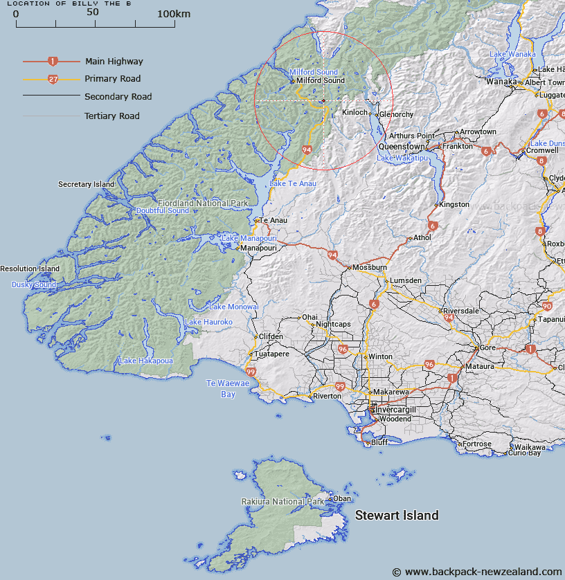
Map showing location of Billy the B


LINZ description: Mountain north-east of Mount Christina and Lake Marian in the Darran Mountains.
Latitude: -44.77566
Longitude: 168.09312
Northing: 5030246.4
Easting: 1211752.6
Land District: Southland
Feat Type: Hill


Scroll down to see a more detailed road map and below that a topographical map showing the location of Billy the B. The road map has been supplied by openstreetmap and the topographical map of Billy the B has been supplied by Land Information New Zealand (LINZ).

Yes you can use the top static map for you school/university project or personal website with a link back. Contact me for any commercial use.

Billy the B Map New Zealand


New Zealand places in our database
[ A ] [ B ] [ C ] [ D ] [ E ] [ F ] [ G ] [ H ] [ I ] [ J ] [ K ] [ L ] [ M ] [ N ] [ O ] [ P ] [ Q ] [ R ] [ S ] [ T ] [ U ] [ V ] [ W ] [ X ] [ Y ] [ Z ]


Closest 20 Hills to Billy the B

Billy the B ( 0km )   Mount Lyttle ( 0km )   Mount Gunn ( 2.42km )   East Peak ( 3.45km )   Mount Christina ( 4.03km )   North Peak ( 4.06km )   Adelaide Peak ( 4.28km )   East Peak ( 4.31km )   Sabre Peak ( 4.51km )   Second Peak ( 4.52km )   South Peak ( 4.72km )   Middle Peak ( 4.75km )   Marian Peak ( 4.83km )   West Peak ( 5.07km )   Barrier Peak ( 5.38km )   Low Peak ( 5.47km )   Mount Gifford ( 5.72km )   Third Peak ( 5.77km )   East Peak ( 5.78km )   High Peak ( 5.8km )   Barrier Knob ( 6.81km )   Students Peak ( 7.68km )   Ocean Peak ( 7.77km )   Mount Suter ( 7.9km )   Cockburn Incline ( 8.01km )   Mount Talbot ( 8.04km )   Mount Lippe ( 8.04km )   Harris Saddle ( 8.3km )   Harris Saddle/Tarahaka Whakatipu ( 8.3km )   The Sentinel ( 8.36km )   Conical Hill ( 8.47km )   Mount Belle ( 8.55km )   Consolation Peak ( 8.73km )   Ngatimamoe Peak ( 8.93km )   Mount Moir ( 9.17km )   The Twins ( 9.29km )   Mount Park ( 9.4km )   Emily Peak ( 9.45km )   Pyramid Peak ( 9.5km )   Mount Charlton ( 9.51km )