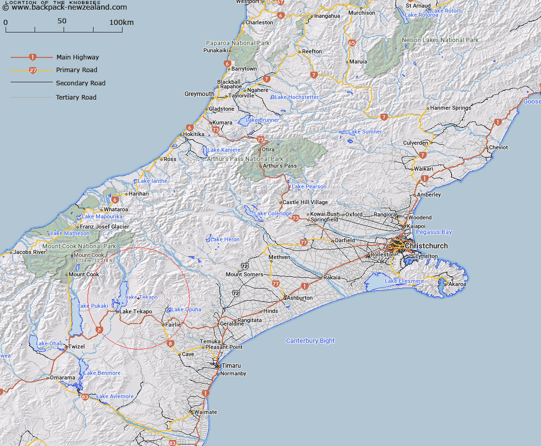
Map showing location of The Knobbies


LINZ description: Series of small knobs on Two Thumb Range east of Lake Tekapo.
Latitude: -43.905695
Longitude: 170.642646
Northing: 5135900
Easting: 1410700
Land District: Canterbury
Feat Type: Range


Scroll down to see a more detailed road map and below that a topographical map showing the location of The Knobbies. The road map has been supplied by openstreetmap and the topographical map of The Knobbies has been supplied by Land Information New Zealand (LINZ).

Yes you can use the top static map for you school/university project or personal website with a link back. Contact me for any commercial use.

The Knobbies Map New Zealand


New Zealand places in our database
[ A ] [ B ] [ C ] [ D ] [ E ] [ F ] [ G ] [ H ] [ I ] [ J ] [ K ] [ L ] [ M ] [ N ] [ O ] [ P ] [ Q ] [ R ] [ S ] [ T ] [ U ] [ V ] [ W ] [ X ] [ Y ] [ Z ]


Closest 20 Ranges to The Knobbies

Richmond Range ( 5.09km )   Sherwood Range ( 17.42km )   Low Claytons ( 20.32km )   Haszard Ridge ( 21.65km )   Old Man Range ( 24.29km )   Albury Range ( 25.36km )   High Claytons ( 26.12km )   Rollesby Range ( 26.48km )   Ben Mcleod Range ( 26.59km )   Hall Range ( 27.54km )   Single Hill Range ( 28km )   Sinclair Range ( 28.88km )   Hewson Range ( 29.86km )   Four Peaks Range ( 32.36km )   Burnett Range ( 32.9km )   Gamack Range ( 32.9km )   Brabazon Range ( 34.37km )   Dalgety Range ( 37.22km )   Liebig Range ( 38.5km )   Black Mountain Range ( 39.89km )   Mary Range ( 40.49km )   Tara Haoa Range ( 41.3km )   Sibbald Range ( 41.74km )   Harper Range ( 42.94km )   Grampian Mountains ( 43.18km )   Malte Brun Range ( 45.44km )   Grays Hills ( 46.26km )   Rhoboro Hills ( 47.8km )   Mount Cook Range ( 48.24km )   Kirikirikatata / Mount Cook Range ( 48.24km )   Moorhouse Range ( 49.13km )   Sealy Range ( 49.47km )   Two Thumb Range ( 49.82km )   Ben Ohau Range ( 49.93km )   Little Rhoboro Hills ( 50.24km )   Dogs Range ( 51.5km )   The Hunters Hills ( 52.23km )   Aroarokaehe Range ( 52.45km )   Peter Range ( 53.53km )   Cloudy Peak Range ( 54.69km )