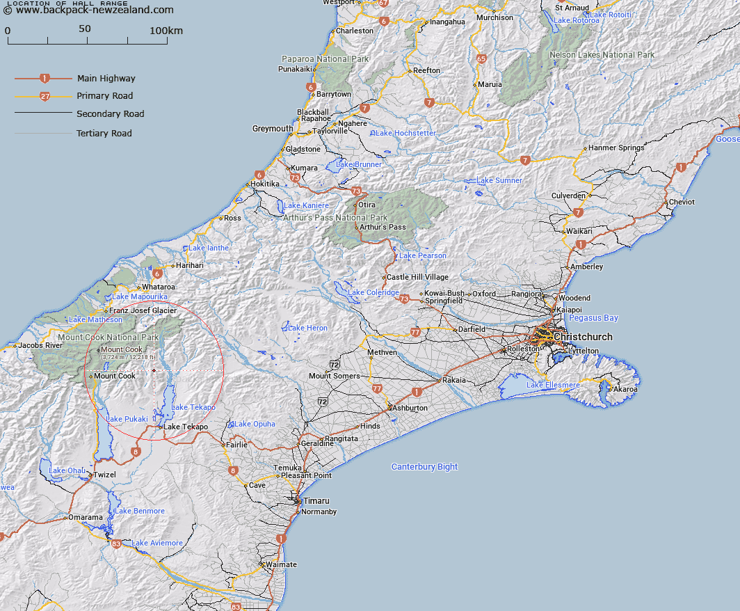
Map showing location of Hall Range
LINZ description: Ridge extending generally southwards from a point on the Liebig Range (2778m) approximately 600m south of Mount Ronald Adair, through Taranaki Peak and Mount Radove to Mistake Peak [ Trig. G (Geodetic Code AAAQ)]. Blocks XII and XVI Cook, Blocks IX and XIII Godley, Block IV Cass, Blocks I, V, IX and X Tekapo North Survey Districts.
Latitude: -43.700528
Longitude: 170.450516
Northing: 5158229.2
Easting: 1394568.9
Land District: Canterbury
Feat Type: Range
Latitude: -43.700528
Longitude: 170.450516
Northing: 5158229.2
Easting: 1394568.9
Land District: Canterbury
Feat Type: Range

Scroll down to see a more detailed road map and below that a topographical map showing the location of Hall Range. The road map has been supplied by openstreetmap and the topographical map of Hall Range has been supplied by Land Information New Zealand (LINZ).
Yes you can use the top static map for you school/university project or personal website with a link back. Contact me for any commercial use.
[ A ] [ B ] [ C ] [ D ] [ E ] [ F ] [ G ] [ H ] [ I ] [ J ] [ K ] [ L ] [ M ] [ N ] [ O ] [ P ] [ Q ] [ R ] [ S ] [ T ] [ U ] [ V ] [ W ] [ X ] [ Y ] [ Z ]