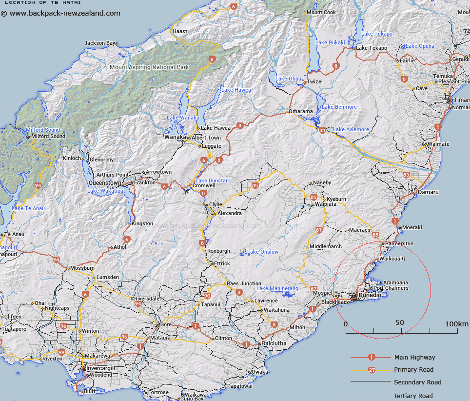
Map showing location of Te Matai


LINZ description: Lookout point near end of Dick Road, on the western side of Okia Flat, Otago Peninsula
Latitude: -45.828977
Longitude: 170.708252
Northing: 4922400
Easting: 1422000
Land District: Otago
Feat Type: Locality


Scroll down to see a more detailed road map and below that a topographical map showing the location of Te Matai. The road map has been supplied by openstreetmap and the topographical map of Te Matai has been supplied by Land Information New Zealand (LINZ).

Yes you can use the top static map for you school/university project or personal website with a link back. Contact me for any commercial use.

Te Matai Map New Zealand


New Zealand places in our database
[ A ] [ B ] [ C ] [ D ] [ E ] [ F ] [ G ] [ H ] [ I ] [ J ] [ K ] [ L ] [ M ] [ N ] [ O ] [ P ] [ Q ] [ R ] [ S ] [ T ] [ U ] [ V ] [ W ] [ X ] [ Y ] [ Z ]


Closest 20 Localitys to Te Matai

Te Matai ( 0km )   Lower Portobello ( 2.74km )   Otakou ( 2.88km )   Gills Corner ( 3km )   Harwood ( 3.15km )   Hoopers Inlet ( 3.94km )   Te Ngaru ( 5.44km )   Aramoana ( 5.79km )   Heyward Point ( 6.28km )   Sandymount ( 7.09km )   Careys Bay ( 7.1km )   Broad Bay ( 7.11km )   Deborah Bay ( 7.22km )   Roseneath ( 8.28km )   Pukehiki ( 8.4km )   Company Bay ( 9km )   Mihiwaka ( 9.05km )   Long Beach ( 9.54km )   Macandrew Bay ( 9.69km )   Macandrew's Bay ( 9.69km )   Osborne ( 10.36km )   P?r?kaunui ( 10.53km )   Mount Cargill ( 10.79km )   Burkes ( 10.99km )   Upper Junction ( 11.25km )   Highcliff ( 12.37km )   Orokonui ( 12.42km )   Michies Crossing ( 13.08km )   The Cove ( 13.49km )   Pigeon Flat ( 13.59km )   Waitati ( 13.89km )   Upper Waitati ( 14.12km )   Gardens ( 14.91km )   Leith Valley ( 15.79km )   Warrington ( 15.91km )   Evansdale ( 16.22km )   Glenleith ( 16.41km )   The Exchange ( 16.98km )   Omimi ( 17.42km )   Cargills Corner ( 17.77km )