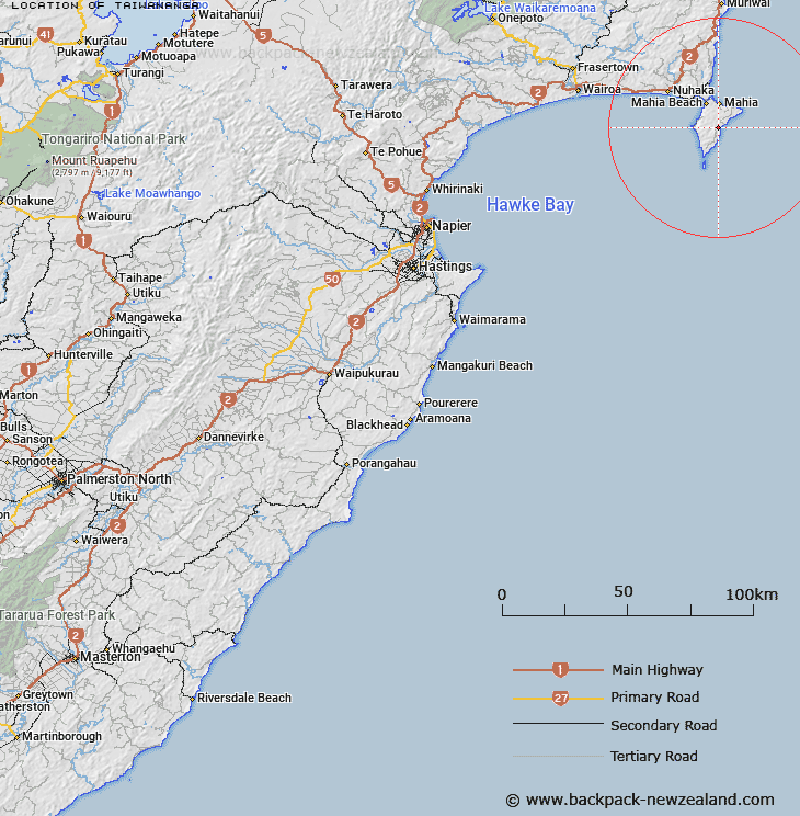
Map showing location of Taiwananga


LINZ description: On the eaastern side of the Mahia Peninsula south of Te Kahika.
Latitude: -39.166637
Longitude: 177.917261
Northing: 5653200
Easting: 2024900
Land District: Hawke's Bay
Feat Type: Locality


Scroll down to see a more detailed road map and below that a topographical map showing the location of Taiwananga. The road map has been supplied by openstreetmap and the topographical map of Taiwananga has been supplied by Land Information New Zealand (LINZ).

Yes you can use the top static map for you school/university project or personal website with a link back. Contact me for any commercial use.

Taiwananga Map New Zealand


New Zealand places in our database
[ A ] [ B ] [ C ] [ D ] [ E ] [ F ] [ G ] [ H ] [ I ] [ J ] [ K ] [ L ] [ M ] [ N ] [ O ] [ P ] [ Q ] [ R ] [ S ] [ T ] [ U ] [ V ] [ W ] [ X ] [ Y ] [ Z ]


Closest 20 Localitys to Taiwananga

Kinikini ( 7.56km )   Whangawehi ( 8.02km )   Mahia ( 8.89km )   Pariokena ( 9.25km )   Mahia Beach ( 9.83km )   Waikokopu ( 12.99km )   Mahanga Beach ( 16.99km )   Nuhaka ( 20.38km )   Morere ( 23.38km )   Tahaenui ( 24.77km )   Mamaka ( 27.44km )   Mamaku ( 27.44km )   Otitangi ( 28.21km )   Otirangi ( 28.21km )   Whakaki ( 31.97km )   Wharerata ( 31.98km )   Te Ana Taumaraukura ( 33.33km )   Anaotamaraukura ( 33.33km )   Rangikahikitia ( 34.46km )   Rangikaikitia ( 34.46km )   Pahangaotekorowhiti ( 37.17km )   Te Tahanga-o-te-konawhiti ( 37.17km )   Papakiateaia ( 37.82km )   Papakiateaio ( 37.82km )   Pukearia ( 38.33km )   Pukiaria ( 38.33km )   Poakahitia ( 38.67km )   Pouakahutia ( 38.67km )   Tuhara ( 38.71km )   Taikawakawa ( 38.82km )   Kaikauakaua ( 38.82km )   Tukemokihi ( 39.94km )   Tukemakihi ( 39.94km )   Potara ( 43.29km )   Paotara ( 43.29km )   Waingake ( 43.55km )   Te Wai Wero ( 43.64km )   Waiwhero ( 43.64km )   Powhirikahawai ( 45.06km )   Konohuri Kahawai ( 45.06km )