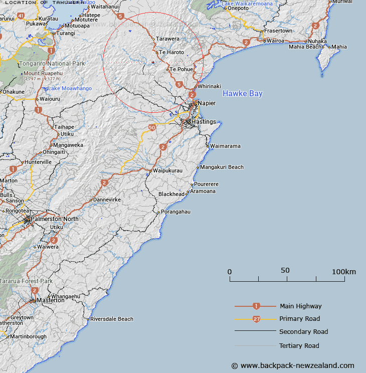
Map showing location of Tahuwera
LINZ description: In Awahono Forest, near confluence of Puneketoro Stream and Mohaka River.
Latitude: -39.198616
Longitude: 176.572235
Northing: 5655100
Easting: 1908500
Land District: Hawke's Bay
Feat Type: Locality
Latitude: -39.198616
Longitude: 176.572235
Northing: 5655100
Easting: 1908500
Land District: Hawke's Bay
Feat Type: Locality

Scroll down to see a more detailed road map and below that a topographical map showing the location of Tahuwera. The road map has been supplied by openstreetmap and the topographical map of Tahuwera has been supplied by Land Information New Zealand (LINZ).
Yes you can use the top static map for you school/university project or personal website with a link back. Contact me for any commercial use.
[ A ] [ B ] [ C ] [ D ] [ E ] [ F ] [ G ] [ H ] [ I ] [ J ] [ K ] [ L ] [ M ] [ N ] [ O ] [ P ] [ Q ] [ R ] [ S ] [ T ] [ U ] [ V ] [ W ] [ X ] [ Y ] [ Z ]