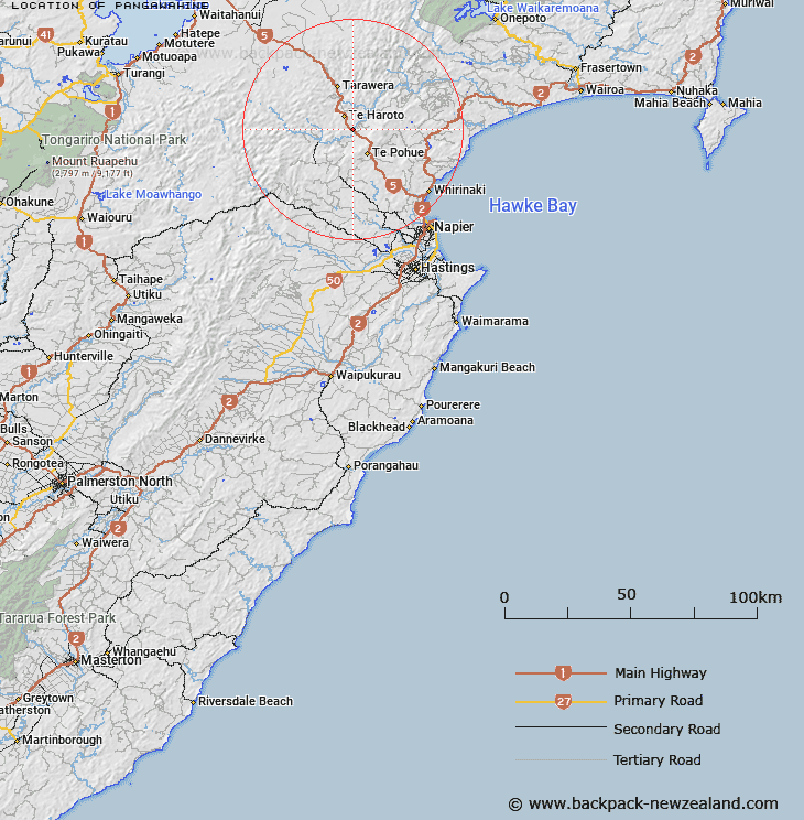
Map showing location of Pangawahine


LINZ description: Near Tarawera, 10km north-west of Te Pohue.
Latitude: -39.170747
Longitude: 176.628681
Northing: 5658000
Easting: 1913500
Land District: Hawke's Bay
Feat Type: Locality


Scroll down to see a more detailed road map and below that a topographical map showing the location of Pangawahine. The road map has been supplied by openstreetmap and the topographical map of Pangawahine has been supplied by Land Information New Zealand (LINZ).

Yes you can use the top static map for you school/university project or personal website with a link back. Contact me for any commercial use.

Pangawahine Map New Zealand


New Zealand places in our database
[ A ] [ B ] [ C ] [ D ] [ E ] [ F ] [ G ] [ H ] [ I ] [ J ] [ K ] [ L ] [ M ] [ N ] [ O ] [ P ] [ Q ] [ R ] [ S ] [ T ] [ U ] [ V ] [ W ] [ X ] [ Y ] [ Z ]


Closest 20 Localitys to Pangawahine

Tangatieke ( 5.42km )   Tangarieke ( 5.42km )   Te Haroto ( 5.59km )   Tahunera ( 5.77km )   Tahuwera ( 5.77km )   Taurangakumu ( 6.53km )   Turangakumu ( 6.53km )   Huramauku ( 9.8km )   Hurumauku ( 9.8km )   Te Pohui ( 10.12km )   Te Pohue ( 10.12km )   Whakaterehu ( 10.27km )   Whakatarehu ( 10.27km )   Tanguro ( 10.57km )   Tanguru ( 10.57km )   Ohurakura ( 10.86km )   Paraweranui ( 11.03km )   Paraneraui ( 11.03km )   Wakahu ( 15.03km )   Whakahu ( 15.03km )   Puketitiri ( 15.26km )   Tarawera ( 16.75km )   Waikoau ( 17.7km )   Patoka ( 19.43km )   Ninehi ( 19.73km )   Ninihi ( 19.73km )   Tutira ( 22.16km )   Pohokura ( 23.26km )   Kahika ( 26.27km )   Rissington ( 29.18km )   Tongoio ( 29.91km )   Tangoio ( 29.91km )   Eskdale ( 30.22km )   Willowford ( 32.45km )   Whirinaki ( 32.57km )   Putorino ( 32.69km )   Waipatiki Beach ( 32.84km )   Waipatiki ( 32.84km )   Whareponga ( 33.07km )   Wareponga ( 33.07km )