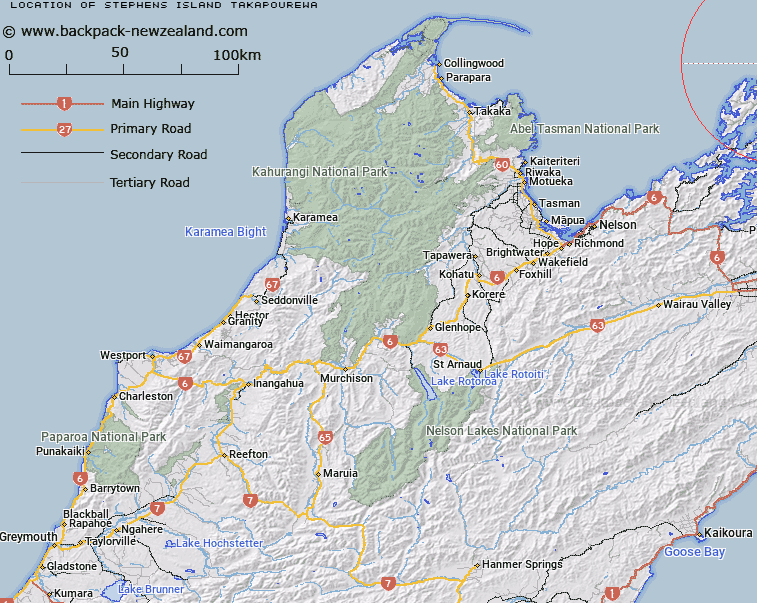
Map showing location of Stephens Island (Takapourewa)


LINZ description: Located at northernmost tip of the Marlborough Sounds, 2km to the north-east of Cape Stephens. Feature shown on: NZTopo50-BN29ptBN28 843973
Latitude: -40.670845
Longitude: 173.997662
Northing: 5497302.8
Easting: 1684321.5
Land District: Nelson
Feat Type: Island


Scroll down to see a more detailed road map and below that a topographical map showing the location of Stephens Island (Takapourewa). The road map has been supplied by openstreetmap and the topographical map of Stephens Island (Takapourewa) has been supplied by Land Information New Zealand (LINZ).

Yes you can use the top static map for you school/university project or personal website with a link back. Contact me for any commercial use.

Stephens Island (Takapourewa) Map New Zealand


New Zealand places in our database
[ A ] [ B ] [ C ] [ D ] [ E ] [ F ] [ G ] [ H ] [ I ] [ J ] [ K ] [ L ] [ M ] [ N ] [ O ] [ P ] [ Q ] [ R ] [ S ] [ T ] [ U ] [ V ] [ W ] [ X ] [ Y ] [ Z ]


Closest 20 Islands to Stephens Island (Takapourewa)

Saddle Rocks ( 2.45km )   Wakaterepapanui Island ( 9.13km )   Rangitoto Islands ( 10.03km )   Victory Island (Moutiti) ( 10.11km )   Seagull Island ( 10.27km )   Fleet Rocks ( 10.72km )   Nelsons Monument (Kaitaore) ( 10.83km )   P?angiangi Island ( 11.08km )   T?nui Island ( 11.97km )   Squadron Rocks ( 12.98km )   May Island ( 15.25km )   Trio Islands (Kuru Pongi) ( 19.05km )   Puotewheke (Scuffle Island) ( 19.15km )   Penguin Island ( 20.26km )   Rangitoto ki te Tonga/D'Urville Island ( 20.86km )   Rangitoto ki te Tonga (D'Urville Island) ( 20.86km )   Rangitoto ke te Tonga (D'Urville Island) ( 20.86km )   Tu Araiawa Island (Fin Island) ( 25.19km )   Te Kakaho Island ( 25.56km )   Stewart Island (Tekuru Kuru) ( 25.58km )   Chetwode Islands ( 25.72km )   Nukuwaiata Island ( 26.29km )   Sentinel Rock ( 26.38km )   Rabbit Island ( 27.32km )   Anatakupu Island ( 27.32km )   The Haystack (Moturaka) ( 27.43km )   Ninepin Rock ( 27.52km )   Oke Rock ( 28.47km )   Rahuinui ( 30.5km )   Te Horo Island ( 30.64km )   Taunahaika Islands ( 31.18km )   Taungahaika Islands ( 31.18km )   H?puka Island ( 31.56km )   Forsyth Island (Te Paruparu) ( 32.57km )   White Horse Rock ( 33.21km )   Titi Island ( 33.34km )   Cone Island ( 33.81km )   Shag Rock ( 34.14km )   Karaka (Hamilton Island) ( 34.39km )   Hautai Island ( 35.42km )