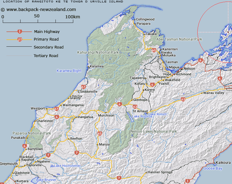
Map showing location of Rangitoto ke te Tonga (D'Urville Island)


LINZ description: Major island at the northern extremity of Marlborough Sounds. Original Māori name for D'Urville Island.
Latitude: -40.826033
Longitude: 173.858606
Northing: 5480200
Easting: 1672400
Land District: Nelson
Feat Type: Island


Scroll down to see a more detailed road map and below that a topographical map showing the location of Rangitoto ke te Tonga (D'Urville Island). The road map has been supplied by openstreetmap and the topographical map of Rangitoto ke te Tonga (D'Urville Island) has been supplied by Land Information New Zealand (LINZ).

Yes you can use the top static map for you school/university project or personal website with a link back. Contact me for any commercial use.

Rangitoto ke te Tonga (D'Urville Island) Map New Zealand


New Zealand places in our database
[ A ] [ B ] [ C ] [ D ] [ E ] [ F ] [ G ] [ H ] [ I ] [ J ] [ K ] [ L ] [ M ] [ N ] [ O ] [ P ] [ Q ] [ R ] [ S ] [ T ] [ U ] [ V ] [ W ] [ X ] [ Y ] [ Z ]


Closest 20 Islands to Rangitoto ke te Tonga (D'Urville Island)

Penguin Island ( 5.22km )   May Island ( 5.71km )   Puotewheke (Scuffle Island) ( 5.89km )   Tu Araiawa Island (Fin Island) ( 6.51km )   Stewart Island (Tekuru Kuru) ( 7.66km )   Anatakupu Island ( 7.88km )   Rabbit Island ( 7.88km )   Squadron Rocks ( 8.24km )   Te Horo Island ( 9.81km )   Rahuinui ( 9.96km )   Fleet Rocks ( 10.32km )   Taungahaika Islands ( 10.47km )   Taunahaika Islands ( 10.47km )   Seagull Island ( 10.61km )   T?nui Island ( 10.76km )   H?puka Island ( 10.78km )   Victory Island (Moutiti) ( 11.06km )   Nelsons Monument (Kaitaore) ( 11.23km )   Trio Islands (Kuru Pongi) ( 11.72km )   P?angiangi Island ( 12.06km )   Cone Island ( 12.96km )   Rangitoto Islands ( 13.05km )   Wakaterepapanui Island ( 14km )   Hautai Island ( 14.65km )   Le Brun Peninsula ( 15.08km )   Le Brun Island ( 15.08km )   Karaka (Hamilton Island) ( 15.5km )   White Horse Rock ( 17.68km )   Oke Rock ( 18km )   Saddle Rocks ( 18.73km )   Ninepin Rock ( 19.18km )   Clara Island ( 19.57km )   Nukuwaiata Island ( 19.92km )   Stephens Island (Takapourewa) ( 20.86km )   Chetwode Islands ( 20.9km )   The Haystack (Moturaka) ( 21.57km )   Te Kakaho Island ( 21.68km )   Te Hoiere ( 22.14km )   Maud Island ( 22.14km )   Forsyth Island (Te Paruparu) ( 23.44km )