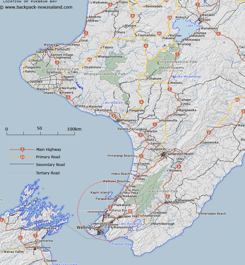
Map showing location of Pukerua Bay


LINZ description: NZTopo50 BP31-Porirua, GR 556 538 and NZTopo50 BP32-Paraparaumu, GR 586 538.
Latitude: -41.051592
Longitude: 174.887241
Northing: 5453800
Easting: 1758600
Land District: Wellington
Feat Type: Suburb


Scroll down to see a more detailed road map and below that a topographical map showing the location of Pukerua Bay. The road map has been supplied by openstreetmap and the topographical map of Pukerua Bay has been supplied by Land Information New Zealand (LINZ).

Yes you can use the top static map for you school/university project or personal website with a link back. Contact me for any commercial use.

Pukerua Bay Map New Zealand


New Zealand places in our database
[ A ] [ B ] [ C ] [ D ] [ E ] [ F ] [ G ] [ H ] [ I ] [ J ] [ K ] [ L ] [ M ] [ N ] [ O ] [ P ] [ Q ] [ R ] [ S ] [ T ] [ U ] [ V ] [ W ] [ X ] [ Y ] [ Z ]


Closest 20 Suburbs to Pukerua Bay

Plimmerton ( 2.7km )   Karehana Bay ( 2.7km )   Camborne ( 4.2km )   Mana ( 5.13km )   Paremata ( 5.46km )   Golden Gate ( 5.96km )   P?uatahanui ( 6.14km )   Pahautanui ( 6.14km )   Pauatahanui ( 6.14km )   Titahi Bay ( 6.93km )   T?tahi Bay ( 6.93km )   Papak?whai ( 7.38km )   Papakowhai ( 7.38km )   Onepoto ( 7.39km )   Ascot Park ( 7.64km )   Whitby ( 7.86km )   Takap?w?hia ( 9.32km )   Aotea ( 9.38km )   Porirua City Centre ( 9.93km )   Porirua City ( 9.93km )   Cannons Creek ( 10.05km )   Porirua East ( 10.46km )   Elsdon ( 10.64km )   R?nui ( 10.74km )   Ranui Heights ( 11.26km )   Kenepuru ( 12.31km )   Waitangirua ( 12.43km )   Linden ( 12.55km )   Lindenvale ( 12.76km )   Greenacres ( 13.17km )   Manor Park ( 14.07km )   Riverstone Terraces ( 14.61km )   Pomare ( 14.73km )   Westhaven ( 14.73km )   Kelson ( 14.8km )   Redwood ( 15.04km )   Grenada North ( 15.16km )   Sundale ( 15.39km )   Taita ( 15.48km )   Holborn ( 15.52km )