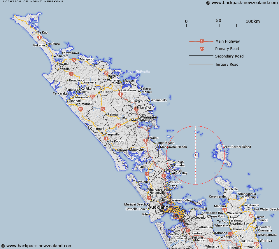
Map showing location of Mount Herekohu


LINZ description: Peak at height 694m south west of Mt Hauturu, Hauturu/Little Barrier Island.
Latitude: -36.199524
Longitude: 175.074411
Northing: 5991926.5
Easting: 1786502
Land District: North Auckland
Feat Type: Hill


Scroll down to see a more detailed road map and below that a topographical map showing the location of Mount Herekohu. The road map has been supplied by openstreetmap and the topographical map of Mount Herekohu has been supplied by Land Information New Zealand (LINZ).

Yes you can use the top static map for you school/university project or personal website with a link back. Contact me for any commercial use.

Mount Herekohu Map New Zealand


New Zealand places in our database
[ A ] [ B ] [ C ] [ D ] [ E ] [ F ] [ G ] [ H ] [ I ] [ J ] [ K ] [ L ] [ M ] [ N ] [ O ] [ P ] [ Q ] [ R ] [ S ] [ T ] [ U ] [ V ] [ W ] [ X ] [ Y ] [ Z ]


Closest 20 Hills to Mount Herekohu

Mount Hauturu ( 0.47km )   Mount Ohakiri ( 0.55km )   Mount Kiriraukawa ( 1.22km )   Mount Orotere ( 1.47km )   Mount Orau ( 1.74km )   Mount Whekauwhekau ( 1.87km )   Mount Ngarahu ( 1.88km )   Mount Hauruia/Bald Rock ( 2.11km )   Castle Peak ( 21.6km )   Mitre Peak ( 22.62km )   Mohunga ( 23.45km )   Moors Peak ( 23.49km )   Walter Hill ( 23.69km )   Mount Overlook ( 23.84km )   Tree Peak ( 25.29km )   Te Heruheru ( 26.37km )   Whangaparapara ( 27.43km )   Maungapiko ( 27.83km )   Mount Young ( 28.08km )   Coopers Castle ( 29.08km )   Mount Heale ( 30.36km )   Mount Matawhero ( 30.36km )   Mount Hobson ( 30.39km )   Wells Hill ( 30.82km )   Tataweka ( 30.82km )   The Pinnacle ( 30.85km )   Mount Taylor ( 31.14km )   Te Ahumata ( 31.89km )   Grey Heights ( 32.12km )   Whangapoua ( 32.66km )   Stony Hill ( 32.79km )   Boyds Hill ( 33.71km )   Tamahunga ( 34.11km )   Komahunga ( 34.2km )   Okupu ( 34.4km )   Raihoa ( 34.53km )   Pukematekeo ( 34.82km )   Sugarloaf ( 34.82km )   Grand View ( 36.88km )   Needle Rocks ( 37.69km )