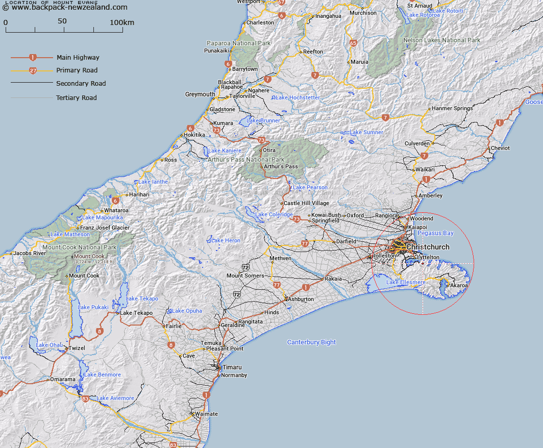
Map showing location of Mount Evans


LINZ description: Hill at height 703m, site of trig V Mount Evans, 2.5km inland and due south of Te Pohue/Camp Bay, Lyttelton Harbour/Whakaraupō.
Latitude: -43.644208
Longitude: 172.781528
Northing: 5167619.8
Easting: 1582379.9
Land District: Canterbury
Feat Type: Hill


Scroll down to see a more detailed road map and below that a topographical map showing the location of Mount Evans. The road map has been supplied by openstreetmap and the topographical map of Mount Evans has been supplied by Land Information New Zealand (LINZ).

Yes you can use the top static map for you school/university project or personal website with a link back. Contact me for any commercial use.

Mount Evans Map New Zealand


New Zealand places in our database
[ A ] [ B ] [ C ] [ D ] [ E ] [ F ] [ G ] [ H ] [ I ] [ J ] [ K ] [ L ] [ M ] [ N ] [ O ] [ P ] [ Q ] [ R ] [ S ] [ T ] [ U ] [ V ] [ W ] [ X ] [ Y ] [ Z ]


Closest 20 Hills to Mount Evans

Mount Evans ( 0km )   The Monument ( 3.87km )   Mount Herbert/Te Ahu Patiki ( 5.96km )   Mount Herbert ( 5.96km )   Herbert Peak ( 5.96km )   Wild Cattle Hill ( 6.65km )   Tauhinukorokio/Mount Pleasant ( 7.54km )   Tauhinukorokio ( 7.54km )   Windsor Castle ( 7.73km )   Mount Cavendish ( 8.03km )   Mount Bradley ( 8.07km )   Mount Fitzgerald ( 8.25km )   The Tors ( 8.97km )   Holmes ( 9.03km )   Mount Sinclair ( 10.24km )   Mount Vernon ( 10.72km )   Witch Hill ( 10.95km )   Zig Zag ( 11.53km )   Sugarloaf ( 11.54km )   Haytor ( 12km )   Marleys Hill ( 12.47km )   Cass Peak ( 12.75km )   Coopers Knob ( 12.79km )   High Bare Peak ( 13.71km )   Pigeon Bay Peak ( 13.91km )   Pearce ( 14.43km )   Graeme ( 14.81km )   French Hill ( 15.22km )   Duvauchelle Peak ( 17.15km )   View Hill ( 18.06km )   Saddle Hill ( 18.56km )   Te Oka ( 18.91km )   Rocky Peak ( 18.98km )   West Peak ( 19.96km )   Okains Peak ( 20.08km )   Devils Gap ( 20.28km )   Takamatua Hill ( 21.56km )   Carews Peak ( 22.08km )   Lavericks ( 22.08km )   Benoit ( 23.91km )