Map showing location of Mount Herbert/Te Ahu Patiki


LINZ description: Feature shown on: NZMS260-M36 892242; NZTopo50-BX24 791625;
Latitude: -43.689391
Longitude: 172.741594
Northing: 5162592.5
Easting: 1579174.7
Land District: Canterbury
Feat Type: Hill


Scroll down to see a more detailed road map and below that a topographical map showing the location of Mount Herbert/Te Ahu Patiki. The road map has been supplied by openstreetmap and the topographical map of Mount Herbert/Te Ahu Patiki has been supplied by Land Information New Zealand (LINZ).

Yes you can use the top static map for you school/university project or personal website with a link back. Contact me for any commercial use.
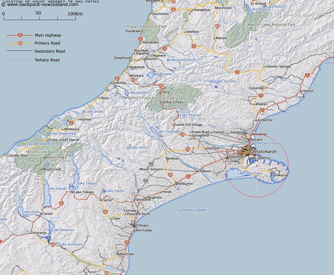
Mount Herbert/Te Ahu Patiki Map New Zealand


New Zealand places in our database
[ A ] [ B ] [ C ] [ D ] [ E ] [ F ] [ G ] [ H ] [ I ] [ J ] [ K ] [ L ] [ M ] [ N ] [ O ] [ P ] [ Q ] [ R ] [ S ] [ T ] [ U ] [ V ] [ W ] [ X ] [ Y ] [ Z ]


Closest 20 Hills to Mount Herbert/Te Ahu Patiki

Mount Bradley ( 2.61km )   The Monument ( 2.69km )   Mount Evans ( 5.96km )   Mount Fitzgerald ( 7.84km )   High Bare Peak ( 8.58km )   Wild Cattle Hill ( 9.3km )   Coopers Knob ( 9.94km )   Mount Sinclair ( 9.99km )   Cass Peak ( 11.19km )   Tauhinukorokio/Mount Pleasant ( 11.23km )   Tauhinukorokio ( 11.23km )   Mount Cavendish ( 11.32km )   The Tors ( 11.49km )   Sugarloaf ( 12.13km )   Mount Vernon ( 12.15km )   Windsor Castle ( 12.2km )   Marleys Hill ( 12.34km )   Witch Hill ( 12.59km )   Holmes ( 12.8km )   French Hill ( 13.19km )   Te Oka ( 14.24km )   Haytor ( 14.85km )   Pigeon Bay Peak ( 15.02km )   Zig Zag ( 15.51km )   Saddle Hill ( 15.67km )   Pearce ( 15.83km )   Devils Gap ( 16.33km )   Rocky Peak ( 16.9km )   Graeme ( 18.07km )   Duvauchelle Peak ( 18.47km )   Carews Peak ( 18.84km )   View Hill ( 20.22km )   Takamatua Hill ( 20.57km )   Okains Peak ( 20.86km )   Bossu ( 21.29km )   West Peak ( 22.03km )   Kaik Hill ( 22.6km )   Aylmers Hill ( 22.78km )   Lavericks ( 23.02km )   Benoit ( 23.31km )